Veselý Žďár
Veselý Žďár | |
|---|---|
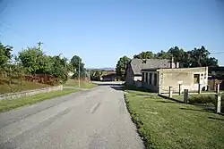 Road through Veselý Žďár | |
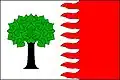 Flag  Coat of arms | |
 Veselý Žďár Location in the Czech Republic | |
| Coordinates: 49°38′23″N 15°31′34″E / 49.63972°N 15.52611°E | |
| Country | |
| Region | Vysočina |
| District | Havlíčkův Brod |
| First mentioned | 1379 |
| Area | |
• Total | 8.70 km2 (3.36 sq mi) |
| Elevation | 491 m (1,611 ft) |
| Population (2025-01-01)[1] | |
• Total | 607 |
| • Density | 70/km2 (180/sq mi) |
| Time zone | UTC+1 (CET) |
| • Summer (DST) | UTC+2 (CEST) |
| Postal code | 580 01 |
| Website | www |
Veselý Žďár is a municipality and village in Havlíčkův Brod District in the Vysočina Region of the Czech Republic. It has about 600 inhabitants.
Veselý Žďár lies approximately 6 kilometres (4 mi) north-west of Havlíčkův Brod, 28 km (17 mi) north of Jihlava, and 94 km (58 mi) south-east of Prague.
Demographics
| Year | Pop. | ±% |
|---|---|---|
| 1869 | 582 | — |
| 1880 | 570 | −2.1% |
| 1890 | 555 | −2.6% |
| 1900 | 521 | −6.1% |
| 1910 | 594 | +14.0% |
| 1921 | 656 | +10.4% |
| 1930 | 640 | −2.4% |
| 1950 | 572 | −10.6% |
| 1961 | 564 | −1.4% |
| 1970 | 526 | −6.7% |
| 1980 | 510 | −3.0% |
| 1991 | 457 | −10.4% |
| 2001 | 470 | +2.8% |
| 2011 | 517 | +10.0% |
| 2021 | 580 | +12.2% |
| Source: Censuses[2][3] | ||
References
- ^ "Population of Municipalities – 1 January 2025". Czech Statistical Office. 2025-05-16.
- ^ "Historický lexikon obcí České republiky 1869–2011" (in Czech). Czech Statistical Office. 2015-12-21.
- ^ "Population Census 2021: Population by sex". Public Database. Czech Statistical Office. 2021-03-27.
External links
Wikimedia Commons has media related to Veselý Žďár.