Kynice
Kynice | |
|---|---|
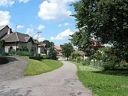 Side street | |
 Kynice Location in the Czech Republic | |
| Coordinates: 49°44′21″N 15°21′37″E / 49.73917°N 15.36028°E | |
| Country | |
| Region | Vysočina |
| District | Havlíčkův Brod |
| First mentioned | 1341 |
| Area | |
• Total | 3.90 km2 (1.51 sq mi) |
| Elevation | 545 m (1,788 ft) |
| Population (2025-01-01)[1] | |
• Total | 104 |
| • Density | 27/km2 (69/sq mi) |
| Time zone | UTC+1 (CET) |
| • Summer (DST) | UTC+2 (CEST) |
| Postal code | 584 01 |
| Website | www |
Kynice is a municipality and village in Havlíčkův Brod District in the Vysočina Region of the Czech Republic. It has about 100 inhabitants.
Kynice lies approximately 22 kilometres (14 mi) north-west of Havlíčkův Brod, 42 km (26 mi) north-west of Jihlava, and 79 km (49 mi) south-east of Prague.
Demographics
| Year | Pop. | ±% |
|---|---|---|
| 1869 | 239 | — |
| 1880 | 233 | −2.5% |
| 1890 | 204 | −12.4% |
| 1900 | 198 | −2.9% |
| 1910 | 190 | −4.0% |
| 1921 | 189 | −0.5% |
| 1930 | 190 | +0.5% |
| 1950 | 162 | −14.7% |
| 1961 | 154 | −4.9% |
| 1970 | 146 | −5.2% |
| 1980 | 124 | −15.1% |
| 1991 | 125 | +0.8% |
| 2001 | 96 | −23.2% |
| 2011 | 86 | −10.4% |
| 2021 | 95 | +10.5% |
| Source: Censuses[2][3] | ||
References
- ^ "Population of Municipalities – 1 January 2025". Czech Statistical Office. 2025-05-16.
- ^ "Historický lexikon obcí České republiky 1869–2011" (in Czech). Czech Statistical Office. 2015-12-21.
- ^ "Population Census 2021: Population by sex". Public Database. Czech Statistical Office. 2021-03-27.
External links
Wikimedia Commons has media related to Kynice.