Letia
Letia | |
|---|---|
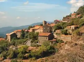 A view of the village of Letia Saint Roch | |
Location of Letia | |
 Letia 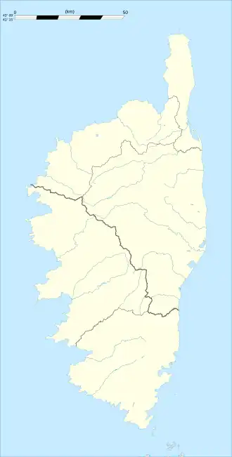 Letia | |
| Coordinates: 42°11′29″N 8°50′54″E / 42.1914°N 8.8483°E | |
| Country | France |
| Region | Corsica |
| Department | Corse-du-Sud |
| Arrondissement | Ajaccio |
| Canton | Sevi-Sorru-Cinarca |
| Government | |
| • Mayor (2020–2026) | Angèle Chiappini[1] |
Area 1 | 36.44 km2 (14.07 sq mi) |
| Population (2022)[2] | 120 |
| • Density | 3.3/km2 (8.5/sq mi) |
| Time zone | UTC+01:00 (CET) |
| • Summer (DST) | UTC+02:00 (CEST) |
| INSEE/Postal code | 2A141 /20160 |
| Elevation | 235–2,084 m (771–6,837 ft) (avg. 660 m or 2,170 ft) |
| 1 French Land Register data, which excludes lakes, ponds, glaciers > 1 km2 (0.386 sq mi or 247 acres) and river estuaries. | |
Letia is a commune in the Corse-du-Sud department of France on the island of Corsica.
Population
| Year | Pop. | ±% p.a. |
|---|---|---|
| 1968 | 285 | — |
| 1975 | 252 | −1.74% |
| 1982 | 204 | −2.97% |
| 1990 | 122 | −6.22% |
| 1999 | 96 | −2.63% |
| 2009 | 109 | +1.28% |
| 2014 | 113 | +0.72% |
| 2020 | 128 | +2.10% |
| Source: INSEE[3] | ||
See also
References
- ^ "Répertoire national des élus: les maires". data.gouv.fr, Plateforme ouverte des données publiques françaises (in French). 2 December 2020.
- ^ "Populations de référence 2022" (in French). The National Institute of Statistics and Economic Studies. 19 December 2024.
- ^ Population en historique depuis 1968, INSEE
Wikimedia Commons has media related to Letia.