Serra-di-Ferro
Serra-di-Ferro
Sarra-di-Farru | |
|---|---|
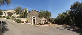 The chapel in Serra-di-Ferro | |
Location of Serra-di-Ferro | |
 Serra-di-Ferro 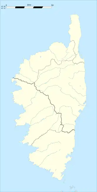 Serra-di-Ferro | |
| Coordinates: 41°43′50″N 8°47′58″E / 41.7306°N 8.7994°E | |
| Country | France |
| Region | Corsica |
| Department | Corse-du-Sud |
| Arrondissement | Ajaccio |
| Canton | Taravo-Ornano |
| Government | |
| • Mayor (2020–2026) | Jean Alfonsi[1] |
Area 1 | 32 km2 (12 sq mi) |
| Population (2022)[2] | 709 |
| • Density | 22/km2 (57/sq mi) |
| Time zone | UTC+01:00 (CET) |
| • Summer (DST) | UTC+02:00 (CEST) |
| INSEE/Postal code | 2A276 /20140 |
| Elevation | 0–140 m (0–459 ft) |
| 1 French Land Register data, which excludes lakes, ponds, glaciers > 1 km2 (0.386 sq mi or 247 acres) and river estuaries. | |
Serra-di-Ferro (French pronunciation: [sɛʁa di fɛʁo]; Corsican: Sarra di Farru) is a commune in the Corse-du-Sud department of France on the island of Corsica.
Population
| Year | Pop. | ±% p.a. |
|---|---|---|
| 1968 | 284 | — |
| 1975 | 334 | +2.34% |
| 1982 | 342 | +0.34% |
| 1990 | 327 | −0.56% |
| 1999 | 352 | +0.82% |
| 2009 | 458 | +2.67% |
| 2014 | 490 | +1.36% |
| 2020 | 563 | +2.34% |
| Source: INSEE[3] | ||
Sights
See also
References
- ^ "Répertoire national des élus: les maires". data.gouv.fr, Plateforme ouverte des données publiques françaises (in French). 2 December 2020.
- ^ "Populations de référence 2022" (in French). The National Institute of Statistics and Economic Studies. 19 December 2024.
- ^ Population en historique depuis 1968, INSEE
External links
Wikimedia Commons has media related to Serra-di-Ferro.