Måvatn
| Måvatn | |
|---|---|
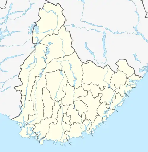 Måvatn Location of the lake Show map of Agder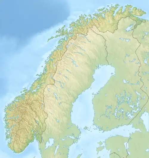 Måvatn Måvatn (Norway) Show map of Norway | |
| Location | Åmli, Agder |
| Coordinates | 58°52′53″N 8°21′21″E / 58.8815°N 08.3558°E / 58.8815; 08.3558 |
| Basin countries | Norway |
| Max. length | 3.3 kilometres (2.1 mi) |
| Max. width | 2.2 kilometres (1.4 mi) |
| Surface area | 3.37 km2 (1.30 sq mi) |
| Shore length1 | 11.09 kilometres (6.89 mi) |
| Surface elevation | 549 metres (1,801 ft) |
| Islands | Storøya, Lisleøya |
| References | NVE |
| 1 Shore length is not a well-defined measure. | |
Måvatn is a lake in the municipality of Åmli in Agder county, Norway. It is located about 2.5 kilometres (1.6 mi) northeast of the village of Askland in the Gjøvdal valley and about 1 kilometre (0.62 mi) south of the municipal border with Nissedal in Telemark county.[1]
See also
References
This article is issued from Wikipedia. The text is available under Creative Commons Attribution-Share Alike 4.0 unless otherwise noted. Additional terms may apply for the media files.