Miřetice (Benešov District)
Miřetice | |
|---|---|
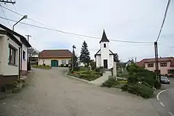 Centre of Miřetice | |
_vlajka.jpg) Flag _znak.jpg) Coat of arms | |
 Miřetice Location in the Czech Republic | |
| Coordinates: 49°39′32″N 14°58′36″E / 49.65889°N 14.97667°E | |
| Country | |
| Region | Central Bohemian |
| District | Benešov |
| First mentioned | 1274 |
| Area | |
• Total | 2.45 km2 (0.95 sq mi) |
| Elevation | 505 m (1,657 ft) |
| Population (2025-01-01)[1] | |
• Total | 240 |
| • Density | 98/km2 (250/sq mi) |
| Time zone | UTC+1 (CET) |
| • Summer (DST) | UTC+2 (CEST) |
| Postal code | 257 65 |
| Website | www |
Miřetice is a municipality and village in Benešov District in the Central Bohemian Region of the Czech Republic. It has about 200 inhabitants.
Demographics
| Year | Pop. | ±% |
|---|---|---|
| 1869 | 261 | — |
| 1880 | 240 | −8.0% |
| 1890 | 227 | −5.4% |
| 1900 | 228 | +0.4% |
| 1910 | 232 | +1.8% |
| 1921 | 234 | +0.9% |
| 1930 | 227 | −3.0% |
| 1950 | 167 | −26.4% |
| 1961 | 194 | +16.2% |
| 1970 | 165 | −14.9% |
| 1980 | 128 | −22.4% |
| 1991 | 125 | −2.3% |
| 2001 | 155 | +24.0% |
| 2011 | 153 | −1.3% |
| 2021 | 202 | +32.0% |
| Source: Censuses[2][3] | ||
References
- ^ "Population of Municipalities – 1 January 2025". Czech Statistical Office. 2025-05-16.
- ^ "Historický lexikon obcí České republiky 1869–2011" (in Czech). Czech Statistical Office. 2015-12-21.
- ^ "Population Census 2021: Population by sex". Public Database. Czech Statistical Office. 2021-03-27.
External links
Wikimedia Commons has media related to Miřetice (Benešov District).