Slověnice
Slověnice | |
|---|---|
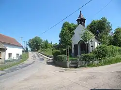 Chapel of Saint Wenceslaus | |
 Slověnice Location in the Czech Republic | |
| Coordinates: 49°45′26″N 14°53′7″E / 49.75722°N 14.88528°E | |
| Country | |
| Region | Central Bohemian |
| District | Benešov |
| First mentioned | 1544 |
| Area | |
• Total | 2.95 km2 (1.14 sq mi) |
| Elevation | 368 m (1,207 ft) |
| Population (2025-01-01)[1] | |
• Total | 49 |
| • Density | 17/km2 (43/sq mi) |
| Time zone | UTC+1 (CET) |
| • Summer (DST) | UTC+2 (CEST) |
| Postal code | 257 26 |
| Website | www |
Slověnice is a municipality and village in Benešov District in the Central Bohemian Region of the Czech Republic. It has about 50 inhabitants.
Demographics
| Year | Pop. | ±% |
|---|---|---|
| 1869 | 172 | — |
| 1880 | 188 | +9.3% |
| 1890 | 174 | −7.4% |
| 1900 | 163 | −6.3% |
| 1910 | 139 | −14.7% |
| 1921 | 152 | +9.4% |
| 1930 | 150 | −1.3% |
| 1950 | 92 | −38.7% |
| 1961 | 98 | +6.5% |
| 1970 | 85 | −13.3% |
| 1980 | 59 | −30.6% |
| 1991 | 41 | −30.5% |
| 2001 | 39 | −4.9% |
| 2011 | 47 | +20.5% |
| 2021 | 30 | −36.2% |
| Source: Censuses[2][3] | ||
References
- ^ "Population of Municipalities – 1 January 2025". Czech Statistical Office. 2025-05-16.
- ^ "Historický lexikon obcí České republiky 1869–2011" (in Czech). Czech Statistical Office. 2015-12-21.
- ^ "Population Census 2021: Population by sex". Public Database. Czech Statistical Office. 2021-03-27.
External links
Wikimedia Commons has media related to Slověnice.