Xaverov
Xaverov | |
|---|---|
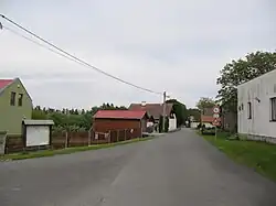 Centre of Xaverov | |
 Flag  Coat of arms | |
 Xaverov Location in the Czech Republic | |
| Coordinates: 49°50′34″N 14°53′8″E / 49.84278°N 14.88556°E | |
| Country | |
| Region | Central Bohemian |
| District | Benešov |
| First mentioned | 1788 |
| Area | |
• Total | 2.17 km2 (0.84 sq mi) |
| Elevation | 460 m (1,510 ft) |
| Population (2025-01-01)[1] | |
• Total | 57 |
| • Density | 26/km2 (68/sq mi) |
| Time zone | UTC+1 (CET) |
| • Summer (DST) | UTC+2 (CEST) |
| Postal code | 285 06 |
| Website | www |
Xaverov is a municipality and village in Benešov District in the Central Bohemian Region of the Czech Republic. It has about 60 inhabitants.
Demographics
| Year | Pop. | ±% |
|---|---|---|
| 1869 | 174 | — |
| 1880 | 191 | +9.8% |
| 1890 | 188 | −1.6% |
| 1900 | 185 | −1.6% |
| 1910 | 163 | −11.9% |
| 1921 | 144 | −11.7% |
| 1930 | 127 | −11.8% |
| 1950 | 94 | −26.0% |
| 1961 | 109 | +16.0% |
| 1970 | 88 | −19.3% |
| 1980 | 51 | −42.0% |
| 1991 | 41 | −19.6% |
| 2001 | 56 | +36.6% |
| 2011 | 66 | +17.9% |
| 2021 | 54 | −18.2% |
| Source: Censuses[2][3] | ||
References
- ^ "Population of Municipalities – 1 January 2025". Czech Statistical Office. 2025-05-16.
- ^ "Historický lexikon obcí České republiky 1869–2011" (in Czech). Czech Statistical Office. 2015-12-21.
- ^ "Population Census 2021: Population by sex". Public Database. Czech Statistical Office. 2021-03-27.
External links
Wikimedia Commons has media related to Xaverov.