Monnetay
Monnetay | |
|---|---|
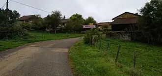 Entrance to the village. | |
Location of Monnetay | |
 Monnetay  Monnetay | |
| Coordinates: 46°27′10″N 5°30′49″E / 46.4528°N 5.5136°E | |
| Country | France |
| Region | Bourgogne-Franche-Comté |
| Department | Jura |
| Arrondissement | Lons-le-Saunier |
| Canton | Saint-Amour |
| Intercommunality | Terre d'Émeraude Communauté |
| Government | |
| • Mayor (2020–2026) | Jean-Marie Paget[1] |
Area 1 | 2.46 km2 (0.95 sq mi) |
| Population (2022)[2] | 16 |
| • Density | 6.5/km2 (17/sq mi) |
| Time zone | UTC+01:00 (CET) |
| • Summer (DST) | UTC+02:00 (CEST) |
| INSEE/Postal code | 39343 /39320 |
| Elevation | 429–598 m (1,407–1,962 ft) |
| 1 French Land Register data, which excludes lakes, ponds, glaciers > 1 km2 (0.386 sq mi or 247 acres) and river estuaries. | |
Monnetay (French pronunciation: [mɔntɛ]) is a commune in the Jura department in Bourgogne-Franche-Comté in eastern France.[3]
Population
| Year | Pop. | ±% p.a. |
|---|---|---|
| 1968 | 25 | — |
| 1975 | 28 | +1.63% |
| 1982 | 22 | −3.39% |
| 1990 | 19 | −1.82% |
| 1999 | 16 | −1.89% |
| 2007 | 13 | −2.56% |
| 2012 | 20 | +9.00% |
| 2017 | 14 | −6.89% |
| Source: INSEE[4] | ||
See also
References
- ^ "Répertoire national des élus: les maires". data.gouv.fr, Plateforme ouverte des données publiques françaises (in French). 9 August 2021.
- ^ "Populations de référence 2022" (in French). The National Institute of Statistics and Economic Studies. 19 December 2024.
- ^ INSEE commune file
- ^ Population en historique depuis 1968, INSEE
Wikimedia Commons has media related to Monnetay.