São Tiago
São Tiago | |
|---|---|
| Municipality of São Tiago | |
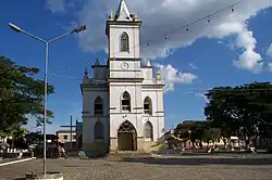 Mother Church of São Tiago | |
 Flag  Seal | |
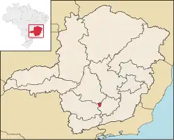 Location in Minas Gerais | |
| Country | |
| State | |
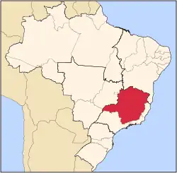
| Region | Southeast |
| Intermediate Region | Barbacena |
| Immediate Region | São João del-Rei |
| Founded | 1 January 1949 |
| Government | |
| • Mayor | Alexandre Nonato Almeida Vivas (PATRI) |
| Area | |
• Total | 572.400 km2 (221.005 sq mi) |
| [1] | |
| Elevation | 1,053 m (3,455 ft) |
| Population (2021)[1] | |
• Total | 10,979 |
| • Density | 19/km2 (50/sq mi) |
| Demonym | são-tiaguense |
| Time zone | UTC−3 (BRT) |
| Postal Code | 36350-000 to 36359-999 |
| HDI (2010) | 0.662 – medium[3] |
| Website | saotiago |
São Tiago is a Brazilian municipality in the state of Minas Gerais. As of 2020 its population is estimated to be 10,960.[4]
Geography
The municipality belongs to the Immediate Geographic Region of São João del-Rei, in the Intermediate Geographic Region of Barbacena.
The municipality is part of the Roman Catholic Diocese of Oliveira.
See also
References
- ^ a b "IBGE São Tiago". IBGE. Retrieved 28 May 2023.
- ^ "Município de São Tiago". cidade-Brasil. Retrieved 28 May 2023.
- ^ "Archived copy" (PDF). United Nations Development Programme (UNDP). Archived from the original (PDF) on 8 July 2014. Retrieved 13 March 2022.
{{cite web}}: CS1 maint: archived copy as title (link) - ^ IBGE 2020