Saint-Esteben
Saint-Esteben
Donoztiri | |
|---|---|
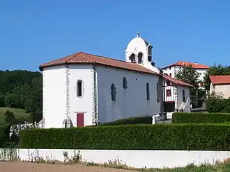 The church of Saint-Esteben | |
.svg.png) Coat of arms | |
Location of Saint-Esteben | |
 Saint-Esteben  Saint-Esteben | |
| Coordinates: 43°20′22″N 1°12′27″W / 43.3394°N 1.2075°W | |
| Country | France |
| Region | Nouvelle-Aquitaine |
| Department | Pyrénées-Atlantiques |
| Arrondissement | Bayonne |
| Canton | Pays de Bidache, Amikuze et Ostibarre |
| Intercommunality | CA Pays Basque |
| Government | |
| • Mayor (2020–2026) | Régine Larranda[1] |
Area 1 | 13.71 km2 (5.29 sq mi) |
| Population (2022)[2] | 443 |
| • Density | 32/km2 (84/sq mi) |
| Time zone | UTC+01:00 (CET) |
| • Summer (DST) | UTC+02:00 (CEST) |
| INSEE/Postal code | 64476 /64640 |
| Elevation | 118–465 m (387–1,526 ft) (avg. 140 m or 460 ft) |
| 1 French Land Register data, which excludes lakes, ponds, glaciers > 1 km2 (0.386 sq mi or 247 acres) and river estuaries. | |
Saint-Esteben (Basque: Donoztiri) is a commune in the Pyrénées-Atlantiques department in south-western France.
It is located in the former province of Lower Navarre.
See also
References
- ^ "Répertoire national des élus: les maires". data.gouv.fr, Plateforme ouverte des données publiques françaises (in French). 9 August 2021.
- ^ "Populations de référence 2022" (in French). The National Institute of Statistics and Economic Studies. 19 December 2024.
Wikimedia Commons has media related to Saint-Esteben.