Saint-Martin-de-Valgalgues
Saint-Martin-de-Valgalgues | |
|---|---|
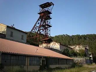 The pithead of the former Alès mine | |
.svg.png) Coat of arms | |
Location of Saint-Martin-de-Valgalgues | |
 Saint-Martin-de-Valgalgues  Saint-Martin-de-Valgalgues | |
| Coordinates: 44°09′50″N 4°04′58″E / 44.1639°N 4.0828°E | |
| Country | France |
| Region | Occitania |
| Department | Gard |
| Arrondissement | Alès |
| Canton | Alès-2 |
| Intercommunality | Alès Agglomération |
| Government | |
| • Mayor (2020–2026) | Claude Cerpedes[1] |
Area 1 | 13.11 km2 (5.06 sq mi) |
| Population (2022)[2] | 4,721 |
| • Density | 360/km2 (930/sq mi) |
| Time zone | UTC+01:00 (CET) |
| • Summer (DST) | UTC+02:00 (CEST) |
| INSEE/Postal code | 30284 /30520 |
| Elevation | 130–365 m (427–1,198 ft) (avg. 149 m or 489 ft) |
| 1 French Land Register data, which excludes lakes, ponds, glaciers > 1 km2 (0.386 sq mi or 247 acres) and river estuaries. | |
Saint-Martin-de-Valgalgues (French pronunciation: [sɛ̃ maʁtɛ̃ də valɡalɡ]; Occitan: Sent Martin de Valgalga) is a commune in the Gard department in southern France.
Population
|
| ||||||||||||||||||||||||||||||||||||||||||||||||||||||
| Source: EHESS[3] and INSEE (1968-2017)[4] | |||||||||||||||||||||||||||||||||||||||||||||||||||||||
See also
References
- ^ "Répertoire national des élus: les maires". data.gouv.fr, Plateforme ouverte des données publiques françaises (in French). 9 August 2021.
- ^ "Populations de référence 2022" (in French). The National Institute of Statistics and Economic Studies. 19 December 2024.
- ^ Des villages de Cassini aux communes d'aujourd'hui: Commune data sheet Saint-Martin-de-Valgalgues, EHESS (in French).
- ^ Population en historique depuis 1968, INSEE
Wikimedia Commons has media related to Saint-Martin-de-Valgalgues.