Verőce, Hungary
Verőce | |
|---|---|
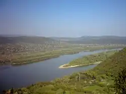 Verőce in the distance from Visegrad | |
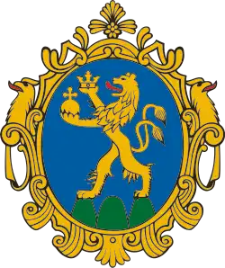
 Flag  Coat of arms | |
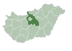 | |
 Verőce Location of Verőce in Hungary. | |
| Coordinates: 47°50′N 19°02′E / 47.833°N 19.033°E | |
| Country | |
| Region | Central Hungary |
| County | Pest |
| Government | |
| • Mayor | Grauszmann György (Ind.) |
| Area | |
• Total | 20.33 km2 (7.85 sq mi) |
| Population (2022)[3] | |
• Total | 4,094 |
| • Density | 200/km2 (520/sq mi) |
| Time zone | UTC+1 (CET) |
| • Summer (DST) | UTC+2 (CEST) |
| Postal code | 2621 |
| Area code | 27 |
| Website | www |
Verőce is a village and commune in Pest County in Hungary. From 1976 to 1990 the village of Verőce was merged with the village of Kismaros, to create a new merged settlement called Verőcemaros. This settlement was disestablished in 1990, when the two villages were again separated and Verőce again became a separate settlement.
Sights
- The riverside system of retaining walls, first started based on the plans of famous Hungarian architect Miklós Ybl.[4]
References
- ^ "Település adatlap". Nemzeti Választási Iroda (in Hungarian). Retrieved 14 July 2024.
- ^ "Detailed Gazetteer of Hungary". www.ksh.hu. Retrieved 14 July 2024.
- ^ "Census 2022". Census 2022. Retrieved 14 July 2024.
- ^ "Ybl Miklós támfal – Verőce". I Love Dunakanyar (in Hungarian). 18 July 2024. Retrieved 14 July 2024.