Člunek
Člunek | |
|---|---|
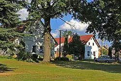 Centre of Člunek | |
_Flag.jpg) Flag _CoA.jpg) Coat of arms | |
 Člunek Location in the Czech Republic | |
| Coordinates: 49°6′41″N 15°7′36″E / 49.11139°N 15.12667°E | |
| Country | |
| Region | South Bohemian |
| District | Jindřichův Hradec |
| First mentioned | 1542 |
| Area | |
• Total | 24.95 km2 (9.63 sq mi) |
| Elevation | 544 m (1,785 ft) |
| Population (2025-01-01)[1] | |
• Total | 485 |
| • Density | 19/km2 (50/sq mi) |
| Time zone | UTC+1 (CET) |
| • Summer (DST) | UTC+2 (CEST) |
| Postal codes | 378 33, 378 53, 378 61 |
| Website | www |
Člunek is a municipality and village in Jindřichův Hradec District in the South Bohemian Region of the Czech Republic. It has about 500 inhabitants.
Člunek lies approximately 11 kilometres (7 mi) south-east of Jindřichův Hradec, 51 km (32 mi) east of České Budějovice, and 120 km (75 mi) south-east of Prague.
Administrative division
Člunek consists of three municipal parts (in brackets population according to the 2021 census):[2]
- Člunek (242)
- Kunějov (75)
- Lomy (155)
Demographics
| Year | Pop. | ±% |
|---|---|---|
| 1869 | 1,917 | — |
| 1880 | 1,852 | −3.4% |
| 1890 | 1,672 | −9.7% |
| 1900 | 1,641 | −1.9% |
| 1910 | 1,489 | −9.3% |
| 1921 | 1,334 | −10.4% |
| 1930 | 1,266 | −5.1% |
| 1950 | 643 | −49.2% |
| 1961 | 580 | −9.8% |
| 1970 | 500 | −13.8% |
| 1980 | 455 | −9.0% |
| 1991 | 441 | −3.1% |
| 2001 | 457 | +3.6% |
| 2011 | 471 | +3.1% |
| 2021 | 472 | +0.2% |
| Source: Censuses[3][4] | ||
References
- ^ "Population of Municipalities – 1 January 2025". Czech Statistical Office. 2025-05-16.
- ^ "Public Census 2021 – basic data". Public Database (in Czech). Czech Statistical Office. 2022.
- ^ "Historický lexikon obcí České republiky 1869–2011" (in Czech). Czech Statistical Office. 2015-12-21.
- ^ "Population Census 2021: Population by sex". Public Database. Czech Statistical Office. 2021-03-27.
External links
Wikimedia Commons has media related to Člunek.