Ratiboř (Jindřichův Hradec District)
Ratiboř | |
|---|---|
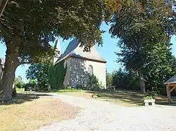 Church of Saint Barbara | |
 Flag _znak.jpg) Coat of arms | |
 Ratiboř Location in the Czech Republic | |
| Coordinates: 49°8′37″N 14°54′54″E / 49.14361°N 14.91500°E | |
| Country | |
| Region | South Bohemian |
| District | Jindřichův Hradec |
| First mentioned | 1265 |
| Area | |
• Total | 11.68 km2 (4.51 sq mi) |
| Elevation | 512 m (1,680 ft) |
| Population (2025-01-01)[1] | |
• Total | 206 |
| • Density | 18/km2 (46/sq mi) |
| Time zone | UTC+1 (CET) |
| • Summer (DST) | UTC+2 (CEST) |
| Postal codes | 377 01, 378 21 |
| Website | www |
Ratiboř is a municipality and village in Jindřichův Hradec District in the South Bohemian Region of the Czech Republic. It has about 200 inhabitants.
Ratiboř lies approximately 8 kilometres (5 mi) west of Jindřichův Hradec, 37 km (23 mi) north-east of České Budějovice, and 111 km (69 mi) south of Prague.
Demographics
| Year | Pop. | ±% |
|---|---|---|
| 1869 | 576 | — |
| 1880 | 545 | −5.4% |
| 1890 | 527 | −3.3% |
| 1900 | 535 | +1.5% |
| 1910 | 510 | −4.7% |
| 1921 | 465 | −8.8% |
| 1930 | 439 | −5.6% |
| 1950 | 327 | −25.5% |
| 1961 | 302 | −7.6% |
| 1970 | 232 | −23.2% |
| 1980 | 211 | −9.1% |
| 1991 | 179 | −15.2% |
| 2001 | 171 | −4.5% |
| 2011 | 185 | +8.2% |
| 2021 | 188 | +1.6% |
| Source: Censuses[2][3] | ||
References
- ^ "Population of Municipalities – 1 January 2025". Czech Statistical Office. 2025-05-16.
- ^ "Historický lexikon obcí České republiky 1869–2011" (in Czech). Czech Statistical Office. 2015-12-21.
- ^ "Population Census 2021: Population by sex". Public Database. Czech Statistical Office. 2021-03-27.
External links
Wikimedia Commons has media related to Ratiboř (Jindřichův Hradec District).