Cep (Jindřichův Hradec District)
Cep | |
|---|---|
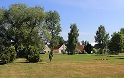 Western part of Cep | |
_vlajka.jpg) Flag _znak.jpg) Coat of arms | |
 Cep Location in the Czech Republic | |
| Coordinates: 48°55′10″N 14°48′27″E / 48.91944°N 14.80750°E | |
| Country | |
| Region | South Bohemian |
| District | Jindřichův Hradec |
| First mentioned | 1404 |
| Area | |
• Total | 35.51 km2 (13.71 sq mi) |
| Elevation | 461 m (1,512 ft) |
| Population (2025-01-01)[1] | |
• Total | 199 |
| • Density | 5.6/km2 (15/sq mi) |
| Time zone | UTC+1 (CET) |
| • Summer (DST) | UTC+2 (CEST) |
| Postal code | 379 01 |
| Website | www |
Cep (German: Trieschel) is a municipality and village in Jindřichův Hradec District in the South Bohemian Region of the Czech Republic. It has about 200 inhabitants.
Demographics
| Year | Pop. | ±% |
|---|---|---|
| 1869 | 495 | — |
| 1880 | 497 | +0.4% |
| 1890 | 506 | +1.8% |
| 1900 | 464 | −8.3% |
| 1910 | 518 | +11.6% |
| 1921 | 517 | −0.2% |
| 1930 | 448 | −13.3% |
| 1950 | 328 | −26.8% |
| 1961 | 308 | −6.1% |
| 1970 | 259 | −15.9% |
| 1980 | 194 | −25.1% |
| 1991 | 184 | −5.2% |
| 2001 | 178 | −3.3% |
| 2011 | 170 | −4.5% |
| 2021 | 158 | −7.1% |
| Source: Censuses[2][3] | ||
References
- ^ "Population of Municipalities – 1 January 2025". Czech Statistical Office. 2025-05-16.
- ^ "Historický lexikon obcí České republiky 1869–2011" (in Czech). Czech Statistical Office. 2015-12-21.
- ^ "Population Census 2021: Population by sex". Public Database. Czech Statistical Office. 2021-03-27.
External links
Wikimedia Commons has media related to Cep.