Doňov
Doňov | |
|---|---|
 Main street | |
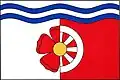 Flag 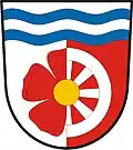 Coat of arms | |
 Doňov Location in the Czech Republic | |
| Coordinates: 49°12′47″N 14°46′34″E / 49.21306°N 14.77611°E | |
| Country | |
| Region | South Bohemian |
| District | Jindřichův Hradec |
| First mentioned | 1402 |
| Area | |
• Total | 5.13 km2 (1.98 sq mi) |
| Elevation | 441 m (1,447 ft) |
| Population (2025-01-01)[1] | |
• Total | 74 |
| • Density | 14/km2 (37/sq mi) |
| Time zone | UTC+1 (CET) |
| • Summer (DST) | UTC+2 (CEST) |
| Postal code | 378 23 |
| Website | www |
Doňov is a municipality and village in Jindřichův Hradec District in the South Bohemian Region of the Czech Republic. It has about 70 inhabitants.
Demographics
| Year | Pop. | ±% |
|---|---|---|
| 1869 | 239 | — |
| 1880 | 251 | +5.0% |
| 1890 | 245 | −2.4% |
| 1900 | 210 | −14.3% |
| 1910 | 210 | +0.0% |
| 1921 | 208 | −1.0% |
| 1930 | 192 | −7.7% |
| 1950 | 140 | −27.1% |
| 1961 | 138 | −1.4% |
| 1970 | 125 | −9.4% |
| 1980 | 104 | −16.8% |
| 1991 | 86 | −17.3% |
| 2001 | 90 | +4.7% |
| 2011 | 79 | −12.2% |
| 2021 | 85 | +7.6% |
| Source: Censuses[2][3] | ||
References
- ^ "Population of Municipalities – 1 January 2025". Czech Statistical Office. 2025-05-16.
- ^ "Historický lexikon obcí České republiky 1869–2011" (in Czech). Czech Statistical Office. 2015-12-21.
- ^ "Population Census 2021: Population by sex". Public Database. Czech Statistical Office. 2021-03-27.
External links
Wikimedia Commons has media related to Doňov.