Braňany
Braňany | |
|---|---|
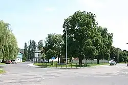 Common in Braňany | |
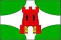 Flag 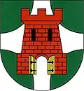 Coat of arms | |
 Braňany Location in the Czech Republic | |
| Coordinates: 50°32′35″N 13°42′0″E / 50.54306°N 13.70000°E | |
| Country | |
| Region | Ústí nad Labem |
| District | Most |
| First mentioned | 1239 |
| Area | |
• Total | 6.13 km2 (2.37 sq mi) |
| Elevation | 253 m (830 ft) |
| Population (2025-01-01)[1] | |
• Total | 1,199 |
| • Density | 200/km2 (510/sq mi) |
| Time zone | UTC+1 (CET) |
| • Summer (DST) | UTC+2 (CEST) |
| Postal code | 435 22 |
| Website | www |
Braňany (German: Prohn) is a municipality and village in Most District at the Ústí nad Labem Region of the Czech Republic. It has about 1,200 inhabitants.
Braňany lies approximately 7 kilometres (4 mi) north-east of Most, 28 km (17 mi) south-west of Ústí nad Labem, and 72 km (45 mi) north-west of Prague.
Administrative division
Braňany consists of two municipal parts (in brackets population according to the 2021 census):[2]
- Braňany (1,147)
- Kaňkov (27)
Demographics
| Year | Pop. | ±% |
|---|---|---|
| 1869 | 290 | — |
| 1880 | 537 | +85.2% |
| 1890 | 412 | −23.3% |
| 1900 | 736 | +78.6% |
| 1910 | 875 | +18.9% |
| 1921 | 1,042 | +19.1% |
| 1930 | 1,095 | +5.1% |
| 1950 | 1,077 | −1.6% |
| 1961 | 1,927 | +78.9% |
| 1970 | 1,706 | −11.5% |
| 1980 | 1,429 | −16.2% |
| 1991 | 1,143 | −20.0% |
| 2001 | 1,169 | +2.3% |
| 2011 | 1,157 | −1.0% |
| 2021 | 1,174 | +1.5% |
| Source: Censuses[3][4] | ||
References
- ^ "Population of Municipalities – 1 January 2025". Czech Statistical Office. 2025-05-16.
- ^ "Public Census 2021 – basic data". Public Database (in Czech). Czech Statistical Office. 2022.
- ^ "Historický lexikon obcí České republiky 1869–2011" (in Czech). Czech Statistical Office. 2015-12-21.
- ^ "Population Census 2021: Population by sex". Public Database. Czech Statistical Office. 2021-03-27.
External links
Wikimedia Commons has media related to Braňany.