Polerady (Most District)
Polerady | |
|---|---|
 Municipal office | |
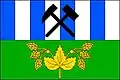 Flag 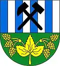 Coat of arms | |
 Polerady Location in the Czech Republic | |
| Coordinates: 50°26′40″N 13°39′10″E / 50.44444°N 13.65278°E | |
| Country | |
| Region | Ústí nad Labem |
| District | Most |
| First mentioned | 1250 |
| Area | |
• Total | 7.08 km2 (2.73 sq mi) |
| Elevation | 218 m (715 ft) |
| Population (2025-01-01)[1] | |
• Total | 234 |
| • Density | 33/km2 (86/sq mi) |
| Time zone | UTC+1 (CET) |
| • Summer (DST) | UTC+2 (CEST) |
| Postal code | 434 01 |
| Website | www |
Polerady (German: Polerad) is a municipality and village in Most District in the Ústí nad Labem Region of the Czech Republic. It has about 200 inhabitants.
Polerady lies approximately 8 kilometres (5 mi) south of Most, 37 km (23 mi) south-west of Ústí nad Labem, and 67 km (42 mi) north-west of Prague.
History
The first written mention of Polerady is from 1250.[2]
Demographics
| Year | Pop. | ±% |
|---|---|---|
| 1869 | 308 | — |
| 1880 | 347 | +12.7% |
| 1890 | 364 | +4.9% |
| 1900 | 452 | +24.2% |
| 1910 | 483 | +6.9% |
| 1921 | 526 | +8.9% |
| 1930 | 628 | +19.4% |
| 1950 | 356 | −43.3% |
| 1961 | 333 | −6.5% |
| 1970 | 274 | −17.7% |
| 1980 | 207 | −24.5% |
| 1991 | 150 | −27.5% |
| 2001 | 215 | +43.3% |
| 2011 | 220 | +2.3% |
| 2021 | 226 | +2.7% |
| Source: Censuses[3][4] | ||
References
- ^ "Population of Municipalities – 1 January 2025". Czech Statistical Office. 2025-05-16.
- ^ "Historie obce Polerady" (in Czech). Obec Polerady. Retrieved 2022-03-26.
- ^ "Historický lexikon obcí České republiky 1869–2011" (in Czech). Czech Statistical Office. 2015-12-21.
- ^ "Population Census 2021: Population by sex". Public Database. Czech Statistical Office. 2021-03-27.
External links
Wikimedia Commons has media related to Polerady (Most District).