Korozluky
Korozluky | |
|---|---|
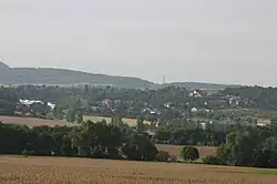 View from the north | |
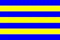 Flag 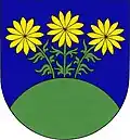 Coat of arms | |
 Korozluky Location in the Czech Republic | |
| Coordinates: 50°28′43″N 13°43′23″E / 50.47861°N 13.72306°E | |
| Country | |
| Region | Ústí nad Labem |
| District | Most |
| First mentioned | 1325 |
| Area | |
• Total | 6.38 km2 (2.46 sq mi) |
| Elevation | 235 m (771 ft) |
| Population (2025-01-01)[1] | |
• Total | 265 |
| • Density | 42/km2 (110/sq mi) |
| Time zone | UTC+1 (CET) |
| • Summer (DST) | UTC+2 (CEST) |
| Postal code | 434 01 |
| Website | www |
Korozluky (German: Kolosoruk) is a municipality and village in Most District in the Ústí nad Labem Region of the Czech Republic. It has about 300 inhabitants.
Korozluky lies approximately 7 kilometres (4 mi) south-east of Most, 31 km (19 mi) south-west of Ústí nad Labem, and 66 km (41 mi) north-west of Prague.
Administrative division
Korozluky consists of two municipal parts (in brackets population according to the 2021 census):[2]
- Korozluky (174)
- Sedlec (49)
Demographics
| Year | Pop. | ±% |
|---|---|---|
| 1869 | 426 | — |
| 1880 | 453 | +6.3% |
| 1890 | 463 | +2.2% |
| 1900 | 483 | +4.3% |
| 1910 | 550 | +13.9% |
| 1921 | 501 | −8.9% |
| 1930 | 581 | +16.0% |
| 1950 | 453 | −22.0% |
| 1961 | 468 | +3.3% |
| 1970 | 378 | −19.2% |
| 1980 | 215 | −43.1% |
| 1991 | 102 | −52.6% |
| 2001 | 123 | +20.6% |
| 2011 | 174 | +41.5% |
| 2021 | 223 | +28.2% |
| Source: Censuses[3][4] | ||
References
- ^ "Population of Municipalities – 1 January 2025". Czech Statistical Office. 2025-05-16.
- ^ "Public Census 2021 – basic data". Public Database (in Czech). Czech Statistical Office. 2022.
- ^ "Historický lexikon obcí České republiky 1869–2011" (in Czech). Czech Statistical Office. 2015-12-21.
- ^ "Population Census 2021: Population by sex". Public Database. Czech Statistical Office. 2021-03-27.
External links
Wikimedia Commons has media related to Korozluky.