Skršín
Skršín | |
|---|---|
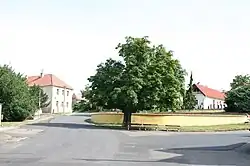 Centre of Skršín | |
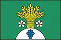 Flag 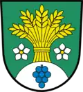 Coat of arms | |
 Skršín Location in the Czech Republic | |
| Coordinates: 50°27′57″N 13°45′16″E / 50.46583°N 13.75444°E | |
| Country | |
| Region | Ústí nad Labem |
| District | Most |
| First mentioned | 1100 |
| Area | |
• Total | 6.98 km2 (2.69 sq mi) |
| Elevation | 323 m (1,060 ft) |
| Population (2025-01-01)[1] | |
• Total | 305 |
| • Density | 44/km2 (110/sq mi) |
| Time zone | UTC+1 (CET) |
| • Summer (DST) | UTC+2 (CEST) |
| Postal code | 434 01 |
| Website | skrsin |
Skršín (German: Skirschina) is a municipality and village in Most District in the Ústí nad Labem Region of the Czech Republic. It has about 300 inhabitants.
Skršín lies approximately 9 kilometres (6 mi) south-east of Most, 30 km (19 mi) south-west of Ústí nad Labem, and 64 km (40 mi) north-west of Prague.
Administrative division
Skršín consists of three municipal parts (in brackets population according to the 2021 census):[2]
- Skršín (154)
- Chrámce (45)
- Dobrčice (68)
Demographics
| Year | Pop. | ±% |
|---|---|---|
| 1869 | 468 | — |
| 1880 | 517 | +10.5% |
| 1890 | 525 | +1.5% |
| 1900 | 489 | −6.9% |
| 1910 | 497 | +1.6% |
| 1921 | 459 | −7.6% |
| 1930 | 457 | −0.4% |
| 1950 | 239 | −47.7% |
| 1961 | 217 | −9.2% |
| 1970 | 187 | −13.8% |
| 1980 | 198 | +5.9% |
| 1991 | 164 | −17.2% |
| 2001 | 197 | +20.1% |
| 2011 | 209 | +6.1% |
| 2021 | 267 | +27.8% |
| Source: Censuses[3][4] | ||
References
- ^ "Population of Municipalities – 1 January 2025". Czech Statistical Office. 2025-05-16.
- ^ "Public Census 2021 – basic data". Public Database (in Czech). Czech Statistical Office. 2022.
- ^ "Historický lexikon obcí České republiky 1869–2011" (in Czech). Czech Statistical Office. 2015-12-21.
- ^ "Population Census 2021: Population by sex". Public Database. Czech Statistical Office. 2021-03-27.
External links
Wikimedia Commons has media related to Skršín.