Malé Březno (Most District)
Malé Březno | |
|---|---|
 Church of Saint John the Evangelist | |
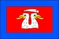 Flag 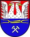 Coat of arms | |
 Malé Březno Location in the Czech Republic | |
| Coordinates: 50°27′45″N 13°33′37″E / 50.46250°N 13.56028°E | |
| Country | |
| Region | Ústí nad Labem |
| District | Most |
| First mentioned | 1369 |
| Area | |
• Total | 19.09 km2 (7.37 sq mi) |
| Elevation | 246 m (807 ft) |
| Population (2025-01-01)[1] | |
• Total | 250 |
| • Density | 13/km2 (34/sq mi) |
| Time zone | UTC+1 (CET) |
| • Summer (DST) | UTC+2 (CEST) |
| Postal code | 434 01 |
| Website | www |
Malé Březno (German: Kleinpriesen) is a municipality and village in Most District in the Ústí nad Labem Region of the Czech Republic. It has about 300 inhabitants.
Malé Březno lies approximately 6 kilometres (4 mi) south-west of Most, 40 km (25 mi) south-west of Ústí nad Labem, and 75 km (47 mi) north-west of Prague.
Administrative division
Malé Březno consists of two municipal parts (in brackets population according to the 2021 census):[2]
- Malé Březno (195)
- Vysoké Březno (30)
Demographics
| Year | Pop. | ±% |
|---|---|---|
| 1869 | 946 | — |
| 1880 | 1,171 | +23.8% |
| 1890 | 1,331 | +13.7% |
| 1900 | 1,488 | +11.8% |
| 1910 | 1,770 | +19.0% |
| 1921 | 1,838 | +3.8% |
| 1930 | 1,929 | +5.0% |
| 1950 | 1,253 | −35.0% |
| 1961 | 1,183 | −5.6% |
| 1970 | 952 | −19.5% |
| 1980 | 175 | −81.6% |
| 1991 | 164 | −6.3% |
| 2001 | 184 | +12.2% |
| 2011 | 212 | +15.2% |
| 2021 | 225 | +6.1% |
| Source: Censuses[3][4] | ||
References
- ^ "Population of Municipalities – 1 January 2025". Czech Statistical Office. 2025-05-16.
- ^ "Public Census 2021 – basic data". Public Database (in Czech). Czech Statistical Office. 2022.
- ^ "Historický lexikon obcí České republiky 1869–2011" (in Czech). Czech Statistical Office. 2015-12-21.
- ^ "Population Census 2021: Population by sex". Public Database. Czech Statistical Office. 2021-03-27.
External links
Wikimedia Commons has media related to Malé Březno (Most District).