Chavanod
Chavanod | |
|---|---|
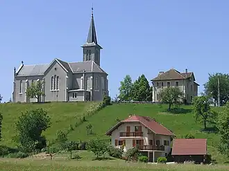 The church in Chavanod | |
Location of Chavanod | |
 Chavanod  Chavanod | |
| Coordinates: 45°53′27″N 6°02′25″E / 45.8908°N 6.0403°E | |
| Country | France |
| Region | Auvergne-Rhône-Alpes |
| Department | Haute-Savoie |
| Arrondissement | Annecy |
| Canton | Annecy-4 |
| Intercommunality | CA Grand Annecy |
| Government | |
| • Mayor (2020–2026) | Franck Bogey[1] |
Area 1 | 13.36 km2 (5.16 sq mi) |
| Population (2022)[2] | 3,024 |
| • Density | 230/km2 (590/sq mi) |
| Time zone | UTC+01:00 (CET) |
| • Summer (DST) | UTC+02:00 (CEST) |
| INSEE/Postal code | 74067 /74650 |
| Elevation | 356–624 m (1,168–2,047 ft) |
| 1 French Land Register data, which excludes lakes, ponds, glaciers > 1 km2 (0.386 sq mi or 247 acres) and river estuaries. | |
Chavanod (French pronunciation: [ʃavano]; Arpitan: Chavanôd) is a commune in the Haute-Savoie department and Auvergne-Rhône-Alpes region of eastern France. It is part of the urban area of Annecy.[3]
Geography
The river Fier forms parts of the commune's northern border.
Population
| Year | Pop. | ±% p.a. |
|---|---|---|
| 1968 | 664 | — |
| 1975 | 1,019 | +6.31% |
| 1982 | 1,254 | +3.01% |
| 1990 | 1,489 | +2.17% |
| 1999 | 1,883 | +2.64% |
| 2007 | 2,167 | +1.77% |
| 2012 | 2,318 | +1.36% |
| 2017 | 2,643 | +2.66% |
| Source: INSEE[4] | ||
See also
References
- ^ "Répertoire national des élus: les maires" (in French). data.gouv.fr, Plateforme ouverte des données publiques françaises. 13 September 2022.
- ^ "Populations de référence 2022" (in French). The National Institute of Statistics and Economic Studies. 19 December 2024.
- ^ Unité urbaine 2020 d'Annecy (74601), INSEE
- ^ Population en historique depuis 1968, INSEE
External links
Wikimedia Commons has media related to Chavanod.