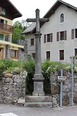
Verchaix
Verchaix | |
|---|---|
 | |
 Coat of arms | |
Location of Verchaix | |
 Verchaix  Verchaix | |
| Coordinates: 46°05′50″N 6°40′37″E / 46.0972°N 6.6769°E | |
| Country | France |
| Region | Auvergne-Rhône-Alpes |
| Department | Haute-Savoie |
| Arrondissement | Bonneville |
| Canton | Cluses |
| Government | |
| • Mayor (2020–2026) | Joël Vaudey[1] |
Area 1 | 15.89 km2 (6.14 sq mi) |
| Population (2022)[2] | 794 |
| • Density | 50/km2 (130/sq mi) |
| Time zone | UTC+01:00 (CET) |
| • Summer (DST) | UTC+02:00 (CEST) |
| INSEE/Postal code | 74294 /74440 |
| Elevation | 654–2,092 m (2,146–6,864 ft) (avg. 788 m or 2,585 ft) |
| 1 French Land Register data, which excludes lakes, ponds, glaciers > 1 km2 (0.386 sq mi or 247 acres) and river estuaries. | |
Verchaix is a commune in the Haute-Savoie department in the Auvergne-Rhône-Alpes region in south-eastern France.
Geography
Verchaix is located on a small plateau above the north bank of the river Giffre. The commune spans an altitude of 654m to 2092m.
Industry
There are a small number of hotels and restaurants and Verchaix is a summer and skiing holiday destination.
Name
The name Verchaix is taken from the verdant south-facing slopes that have traditionally been used in viticulture.
See also
References
- ^ "Répertoire national des élus: les maires". data.gouv.fr, Plateforme ouverte des données publiques françaises (in French). 2 December 2020.
- ^ "Populations de référence 2022" (in French). The National Institute of Statistics and Economic Studies. 19 December 2024.
Wikimedia Commons has media related to Verchaix.