Lucinges
Lucinges | |
|---|---|
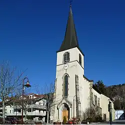 The church in Lucinges | |
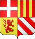 Coat of arms | |
Location of Lucinges | |
 Lucinges  Lucinges | |
| Coordinates: 46°11′26″N 6°19′08″E / 46.1906°N 6.3189°E | |
| Country | France |
| Region | Auvergne-Rhône-Alpes |
| Department | Haute-Savoie |
| Arrondissement | Saint-Julien-en-Genevois |
| Canton | Gaillard |
| Intercommunality | Annemasse - Les Voirons Agglomération |
| Government | |
| • Mayor (2020–2026) | Jean-Luc Soulat[1] |
Area 1 | 7.69 km2 (2.97 sq mi) |
| Population (2022)[2] | 1,709 |
| • Density | 220/km2 (580/sq mi) |
| Time zone | UTC+01:00 (CET) |
| • Summer (DST) | UTC+02:00 (CEST) |
| INSEE/Postal code | 74153 /74380 |
| Elevation | 525–1,400 m (1,722–4,593 ft) |
| Website | Lucinges.fr |
| 1 French Land Register data, which excludes lakes, ponds, glaciers > 1 km2 (0.386 sq mi or 247 acres) and river estuaries. | |
Lucinges (French pronunciation: [lysɛ̃ʒ]; Arpitan: Leçinjos) is a commune in the Haute-Savoie department in the Auvergne-Rhône-Alpes region in south-eastern France.
Geography
Lucinges is located 8 kilometres (5.0 mi) of Annemasse.
Neighboring Communities
See also
References
- ^ "Répertoire national des élus: les maires". data.gouv.fr, Plateforme ouverte des données publiques françaises (in French). 2 December 2020.
- ^ "Populations de référence 2022" (in French). The National Institute of Statistics and Economic Studies. 19 December 2024.
Wikimedia Commons has media related to Lucinges.