Dyje (Znojmo District)
Dyje | |
|---|---|
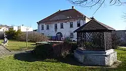 Dyje Castle | |
 Flag 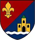 Coat of arms | |
 Dyje Location in the Czech Republic | |
| Coordinates: 48°50′50″N 16°6′59″E / 48.84722°N 16.11639°E | |
| Country | |
| Region | South Moravian |
| District | Znojmo |
| First mentioned | 1283 |
| Area | |
• Total | 4.60 km2 (1.78 sq mi) |
| Elevation | 214 m (702 ft) |
| Population (2025-01-01)[1] | |
• Total | 508 |
| • Density | 110/km2 (290/sq mi) |
| Time zone | UTC+1 (CET) |
| • Summer (DST) | UTC+2 (CEST) |
| Postal code | 669 02 |
| Website | www |
Dyje (German: Mühlfraun) is a municipality and village in Znojmo District in the South Moravian Region of the Czech Republic. It has about 500 inhabitants.
Dyje lies approximately 7 kilometres (4 mi) east of Znojmo, 53 km (33 mi) south-west of Brno, and 185 km (115 mi) south-east of Prague.
Demographics
| Year | Pop. | ±% |
|---|---|---|
| 1869 | 493 | — |
| 1880 | 464 | −5.9% |
| 1890 | 454 | −2.2% |
| 1900 | 455 | +0.2% |
| 1910 | 461 | +1.3% |
| 1921 | 489 | +6.1% |
| 1930 | 519 | +6.1% |
| 1950 | 480 | −7.5% |
| 1961 | 448 | −6.7% |
| 1970 | 391 | −12.7% |
| 1980 | 425 | +8.7% |
| 1991 | 374 | −12.0% |
| 2001 | 356 | −4.8% |
| 2011 | 420 | +18.0% |
| 2021 | 492 | +17.1% |
| Source: Censuses[2][3] | ||
References
- ^ "Population of Municipalities – 1 January 2025". Czech Statistical Office. 2025-05-16.
- ^ "Historický lexikon obcí České republiky 1869–2011" (in Czech). Czech Statistical Office. 2015-12-21.
- ^ "Population Census 2021: Population by sex". Public Database. Czech Statistical Office. 2021-03-27.
External links
Wikimedia Commons has media related to Dyje (Znojmo District).