Slup, Czech Republic
Slup | |
|---|---|
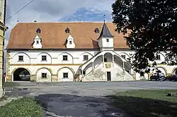 Watermill, a national cultural monument | |
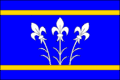 Flag 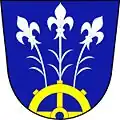 Coat of arms | |
 Slup Location in the Czech Republic | |
| Coordinates: 48°46′54″N 16°11′57″E / 48.78167°N 16.19917°E | |
| Country | |
| Region | South Moravian |
| District | Znojmo |
| First mentioned | 1228 |
| Area | |
• Total | 15.72 km2 (6.07 sq mi) |
| Elevation | 191 m (627 ft) |
| Population (2025-01-01)[1] | |
• Total | 536 |
| • Density | 34/km2 (88/sq mi) |
| Time zone | UTC+1 (CET) |
| • Summer (DST) | UTC+2 (CEST) |
| Postal code | 671 28 |
| Website | www |
Slup (until 1949 Čule; German: Zulb) is a municipality and village in Znojmo District in the South Moravian Region of the Czech Republic. It has about 500 inhabitants.
Slup lies approximately 15 kilometres (9 mi) south-east of Znojmo, 58 km (36 mi) south-west of Brno, and 195 km (121 mi) south-east of Prague.
Administrative division
Slup consists of two municipal parts (in brackets population according to the 2021 census):[2]
- Slup (419)
- Oleksovičky (75)
Demographics
| Year | Pop. | ±% |
|---|---|---|
| 1869 | 1,299 | — |
| 1880 | 1,483 | +14.2% |
| 1890 | 1,592 | +7.3% |
| 1900 | 1,646 | +3.4% |
| 1910 | 1,725 | +4.8% |
| 1921 | 1,700 | −1.4% |
| 1930 | 1,693 | −0.4% |
| 1950 | 697 | −58.8% |
| 1961 | 648 | −7.0% |
| 1970 | 564 | −13.0% |
| 1980 | 534 | −5.3% |
| 1991 | 437 | −18.2% |
| 2001 | 408 | −6.6% |
| 2011 | 438 | +7.4% |
| 2021 | 494 | +12.8% |
| Source: Censuses[3][4] | ||
References
- ^ "Population of Municipalities – 1 January 2025". Czech Statistical Office. 2025-05-16.
- ^ "Public Census 2021 – basic data". Public Database (in Czech). Czech Statistical Office. 2022.
- ^ "Historický lexikon obcí České republiky 1869–2011" (in Czech). Czech Statistical Office. 2015-12-21.
- ^ "Population Census 2021: Population by sex". Public Database. Czech Statistical Office. 2021-03-27.
External links
Wikimedia Commons has media related to Slup.