Jamolice
Jamolice | |
|---|---|
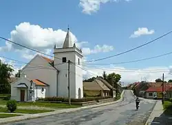 Church of the Assumption of the Virgin Mary | |
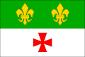 Flag 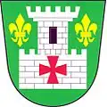 Coat of arms | |
 Jamolice Location in the Czech Republic | |
| Coordinates: 49°4′2″N 16°15′13″E / 49.06722°N 16.25361°E | |
| Country | |
| Region | South Moravian |
| District | Znojmo |
| First mentioned | 1281 |
| Area | |
• Total | 12.94 km2 (5.00 sq mi) |
| Elevation | 350 m (1,150 ft) |
| Population (2025-01-01)[1] | |
• Total | 452 |
| • Density | 35/km2 (90/sq mi) |
| Time zone | UTC+1 (CET) |
| • Summer (DST) | UTC+2 (CEST) |
| Postal code | 672 01 |
| Website | www |
Jamolice (German: Jamolitz) is a municipality and village in Znojmo District in the South Moravian Region of the Czech Republic. It has about 500 inhabitants.
Jamolice lies approximately 30 kilometres (19 mi) north-east of Znojmo, 30 km (19 mi) south-west of Brno, and 174 km (108 mi) south-east of Prague.
Demographics
| Year | Pop. | ±% |
|---|---|---|
| 1869 | 471 | — |
| 1880 | 493 | +4.7% |
| 1890 | 525 | +6.5% |
| 1900 | 570 | +8.6% |
| 1910 | 604 | +6.0% |
| 1921 | 650 | +7.6% |
| 1930 | 644 | −0.9% |
| 1950 | 576 | −10.6% |
| 1961 | 603 | +4.7% |
| 1970 | 519 | −13.9% |
| 1980 | 487 | −6.2% |
| 1991 | 438 | −10.1% |
| 2001 | 446 | +1.8% |
| 2011 | 431 | −3.4% |
| 2021 | 433 | +0.5% |
| Source: Censuses[2][3] | ||
References
- ^ "Population of Municipalities – 1 January 2025". Czech Statistical Office. 2025-05-16.
- ^ "Historický lexikon obcí České republiky 1869–2011" (in Czech). Czech Statistical Office. 2015-12-21.
- ^ "Population Census 2021: Population by sex". Public Database. Czech Statistical Office. 2021-03-27.
External links
Wikimedia Commons has media related to Jamolice.