Trstěnice (Znojmo District)
Trstěnice | |
|---|---|
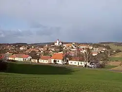 General view | |
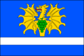 Flag 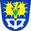 Coat of arms | |
 Trstěnice Location in the Czech Republic | |
| Coordinates: 48°59′12″N 16°11′44″E / 48.98667°N 16.19556°E | |
| Country | |
| Region | South Moravian |
| District | Znojmo |
| First mentioned | 1247 |
| Area | |
• Total | 14.36 km2 (5.54 sq mi) |
| Elevation | 258 m (846 ft) |
| Population (2025-01-01)[1] | |
• Total | 520 |
| • Density | 36/km2 (94/sq mi) |
| Time zone | UTC+1 (CET) |
| • Summer (DST) | UTC+2 (CEST) |
| Postal code | 671 71 |
| Website | www |
Trstěnice is a municipality and village in Znojmo District in the South Moravian Region of the Czech Republic. It has about 500 inhabitants.
Trstěnice lies approximately 20 kilometres (12 mi) north-east of Znojmo, 39 km (24 mi) south-west of Brno, and 178 km (111 mi) south-east of Prague.
Demographics
| Year | Pop. | ±% |
|---|---|---|
| 1869 | 645 | — |
| 1880 | 690 | +7.0% |
| 1890 | 704 | +2.0% |
| 1900 | 739 | +5.0% |
| 1910 | 803 | +8.7% |
| 1921 | 872 | +8.6% |
| 1930 | 820 | −6.0% |
| 1950 | 753 | −8.2% |
| 1961 | 758 | +0.7% |
| 1970 | 682 | −10.0% |
| 1980 | 628 | −7.9% |
| 1991 | 572 | −8.9% |
| 2001 | 567 | −0.9% |
| 2011 | 542 | −4.4% |
| 2021 | 533 | −1.7% |
| Source: Censuses[2][3] | ||
References
- ^ "Population of Municipalities – 1 January 2025". Czech Statistical Office. 2025-05-16.
- ^ "Historický lexikon obcí České republiky 1869–2011" (in Czech). Czech Statistical Office. 2015-12-21.
- ^ "Population Census 2021: Population by sex". Public Database. Czech Statistical Office. 2021-03-27.
External links
Wikimedia Commons has media related to Trstěnice (Znojmo District).