Hodonín (Chrudim District)
Hodonín | |
|---|---|
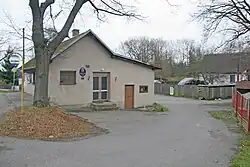 Municipal office | |
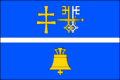 Flag 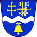 Coat of arms | |
 Hodonín Location in the Czech Republic | |
| Coordinates: 49°50′13″N 15°47′14″E / 49.83694°N 15.78722°E | |
| Country | |
| Region | Pardubice |
| District | Chrudim |
| First mentioned | 1329 |
| Area | |
• Total | 6.95 km2 (2.68 sq mi) |
| Elevation | 530 m (1,740 ft) |
| Population (2025-01-01)[1] | |
• Total | 82 |
| • Density | 12/km2 (31/sq mi) |
| Time zone | UTC+1 (CET) |
| • Summer (DST) | UTC+2 (CEST) |
| Postal code | 538 25 |
| Website | www |
Hodonín (Czech pronunciation: [ˈɦodoɲiːn]) is a municipality and village in Chrudim District in the Pardubice Region of the Czech Republic. It has about 80 inhabitants.
Demographics
| Year | Pop. | ±% |
|---|---|---|
| 1869 | 212 | — |
| 1880 | 209 | −1.4% |
| 1890 | 234 | +12.0% |
| 1900 | 220 | −6.0% |
| 1910 | 235 | +6.8% |
| 1921 | 227 | −3.4% |
| 1930 | 229 | +0.9% |
| 1950 | 180 | −21.4% |
| 1961 | 168 | −6.7% |
| 1970 | 132 | −21.4% |
| 1980 | 109 | −17.4% |
| 1991 | 100 | −8.3% |
| 2001 | 97 | −3.0% |
| 2011 | 96 | −1.0% |
| 2021 | 73 | −24.0% |
| Source: Censuses[2][3] | ||
References
- ^ "Population of Municipalities – 1 January 2025". Czech Statistical Office. 2025-05-16.
- ^ "Historický lexikon obcí České republiky 1869–2011" (in Czech). Czech Statistical Office. 2015-12-21.
- ^ "Population Census 2021: Population by sex". Public Database. Czech Statistical Office. 2021-03-27.
External links
Wikimedia Commons has media related to Hodonín (Chrudim District).