Křižanovice (Chrudim District)
Křižanovice | |
|---|---|
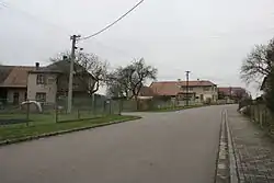 A street in Křižanovice | |
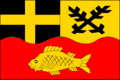 Flag 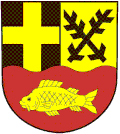 Coat of arms | |
 Křižanovice Location in the Czech Republic | |
| Coordinates: 49°51′34″N 15°45′42″E / 49.85944°N 15.76167°E | |
| Country | |
| Region | Pardubice |
| District | Chrudim |
| First mentioned | 1329 |
| Area | |
• Total | 3.13 km2 (1.21 sq mi) |
| Elevation | 480 m (1,570 ft) |
| Population (2025-01-01)[1] | |
• Total | 123 |
| • Density | 39/km2 (100/sq mi) |
| Time zone | UTC+1 (CET) |
| • Summer (DST) | UTC+2 (CEST) |
| Postal code | 538 21 |
| Website | www |
Křižanovice is a municipality and village in Chrudim District in the Pardubice Region of the Czech Republic. It has about 100 inhabitants.
Demographics
| Year | Pop. | ±% |
|---|---|---|
| 1869 | 155 | — |
| 1880 | 161 | +3.9% |
| 1890 | 180 | +11.8% |
| 1900 | 181 | +0.6% |
| 1910 | 165 | −8.8% |
| 1921 | 175 | +6.1% |
| 1930 | 165 | −5.7% |
| 1950 | 301 | +82.4% |
| 1961 | 173 | −42.5% |
| 1970 | 159 | −8.1% |
| 1980 | 132 | −17.0% |
| 1991 | 118 | −10.6% |
| 2001 | 118 | +0.0% |
| 2011 | 105 | −11.0% |
| 2021 | 123 | +17.1% |
| Source: Censuses[2][3] | ||
References
- ^ "Population of Municipalities – 1 January 2025". Czech Statistical Office. 2025-05-16.
- ^ "Historický lexikon obcí České republiky 1869–2011" (in Czech). Czech Statistical Office. 2015-12-21.
- ^ "Population Census 2021: Population by sex". Public Database. Czech Statistical Office. 2021-03-27.
External links
Wikimedia Commons has media related to Křižanovice (Chrudim District).