Kurovice
Kurovice | |
|---|---|
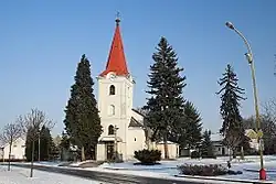 Church of Saint Cunigunde | |
 Flag  Coat of arms | |
 Kurovice Location in the Czech Republic | |
| Coordinates: 49°17′21″N 17°30′56″E / 49.28917°N 17.51556°E | |
| Country | |
| Region | Zlín |
| District | Kroměříž |
| First mentioned | 1276 |
| Area | |
• Total | 5.50 km2 (2.12 sq mi) |
| Elevation | 211 m (692 ft) |
| Population (2025-01-01)[1] | |
• Total | 265 |
| • Density | 48/km2 (120/sq mi) |
| Time zone | UTC+1 (CET) |
| • Summer (DST) | UTC+2 (CEST) |
| Postal code | 768 52 |
| Website | www |
Kurovice is a municipality and village in Kroměříž District in the Zlín Region of the Czech Republic. It has about 300 inhabitants.
Kurovice lies approximately 9 kilometres (6 mi) east of Kroměříž, 13 km (8 mi) north-west of Zlín, and 240 km (150 mi) east of Prague.
Demographics
| Year | Pop. | ±% |
|---|---|---|
| 1869 | 255 | — |
| 1880 | 483 | +89.4% |
| 1890 | 498 | +3.1% |
| 1900 | 492 | −1.2% |
| 1910 | 517 | +5.1% |
| 1921 | 529 | +2.3% |
| 1930 | 493 | −6.8% |
| 1950 | 417 | −15.4% |
| 1961 | 390 | −6.5% |
| 1970 | 341 | −12.6% |
| 1980 | 290 | −15.0% |
| 1991 | 265 | −8.6% |
| 2001 | 251 | −5.3% |
| 2011 | 248 | −1.2% |
| 2021 | 254 | +2.4% |
| Source: Censuses[2][3] | ||
References
- ^ "Population of Municipalities – 1 January 2025". Czech Statistical Office. 2025-05-16.
- ^ "Historický lexikon obcí České republiky 1869–2011" (in Czech). Czech Statistical Office. 2015-12-21.
- ^ "Population Census 2021: Population by sex". Public Database. Czech Statistical Office. 2021-03-27.
External links
Wikimedia Commons has media related to Kurovice.