Pacetluky
Pacetluky | |
|---|---|
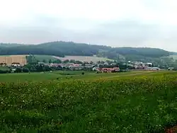 General view | |
 Flag  Coat of arms | |
 Pacetluky Location in the Czech Republic | |
| Coordinates: 49°22′46″N 17°33′57″E / 49.37944°N 17.56583°E | |
| Country | |
| Region | Zlín |
| District | Kroměříž |
| First mentioned | 1141 |
| Area | |
• Total | 2.56 km2 (0.99 sq mi) |
| Elevation | 277 m (909 ft) |
| Population (2025-01-01)[1] | |
• Total | 247 |
| • Density | 96/km2 (250/sq mi) |
| Time zone | UTC+1 (CET) |
| • Summer (DST) | UTC+2 (CEST) |
| Postal code | 768 43 |
| Website | www |
Pacetluky is a municipality and village in Kroměříž District in the Zlín Region of the Czech Republic. It has about 200 inhabitants.
Pacetluky lies approximately 16 kilometres (10 mi) north-east of Kroměříž, 19 km (12 mi) north-west of Zlín, and 240 km (150 mi) east of Prague.
Demographics
| Year | Pop. | ±% |
|---|---|---|
| 1869 | 243 | — |
| 1880 | 252 | +3.7% |
| 1890 | 259 | +2.8% |
| 1900 | 302 | +16.6% |
| 1910 | 286 | −5.3% |
| 1921 | 286 | +0.0% |
| 1930 | 299 | +4.5% |
| 1950 | 267 | −10.7% |
| 1961 | 312 | +16.9% |
| 1970 | 291 | −6.7% |
| 1980 | 272 | −6.5% |
| 1991 | 242 | −11.0% |
| 2001 | 223 | −7.9% |
| 2011 | 214 | −4.0% |
| 2021 | 212 | −0.9% |
| Source: Censuses[2][3] | ||
References
- ^ "Population of Municipalities – 1 January 2025". Czech Statistical Office. 2025-05-16.
- ^ "Historický lexikon obcí České republiky 1869–2011" (in Czech). Czech Statistical Office. 2015-12-21.
- ^ "Population Census 2021: Population by sex". Public Database. Czech Statistical Office. 2021-03-27.
External links
Wikimedia Commons has media related to Pacetluky.