La Feuillie, Seine-Maritime
La Feuillie | |
|---|---|
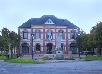 The town hall in La Feuillie | |
.svg.png) Coat of arms | |
Location of La Feuillie | |
 La Feuillie  La Feuillie | |
| Coordinates: 49°27′47″N 1°30′53″E / 49.4631°N 1.5147°E | |
| Country | France |
| Region | Normandy |
| Department | Seine-Maritime |
| Arrondissement | Dieppe |
| Canton | Gournay-en-Bray |
| Intercommunality | CC 4 rivières |
| Government | |
| • Mayor (2020–2026) | Pascal Legay[1] |
Area 1 | 139.76 km2 (53.96 sq mi) |
| Population (2022)[2] | 1,245 |
| • Density | 8.9/km2 (23/sq mi) |
| Time zone | UTC+01:00 (CET) |
| • Summer (DST) | UTC+02:00 (CEST) |
| INSEE/Postal code | 76263 /76220 |
| Elevation | 90–219 m (295–719 ft) (avg. 175 m or 574 ft) |
| 1 French Land Register data, which excludes lakes, ponds, glaciers > 1 km2 (0.386 sq mi or 247 acres) and river estuaries. | |
La Feuillie is a commune in the Seine-Maritime department in the Normandy region in north-western France.
Geography
A forestry and farming village situated in the Pays de Bray, some 21 miles (34 km) east of Rouen at the junction of the N 31, the D 62, 84, 128 and 921 (former N 321) roads.
Population
| Year | Pop. | ±% p.a. |
|---|---|---|
| 1968 | 1,021 | — |
| 1975 | 1,022 | +0.01% |
| 1982 | 1,030 | +0.11% |
| 1990 | 1,008 | −0.27% |
| 1999 | 1,096 | +0.93% |
| 2007 | 1,207 | +1.21% |
| 2012 | 1,275 | +1.10% |
| 2017 | 1,296 | +0.33% |
| Source: INSEE[3] | ||
Places of interest
See also
References
- ^ "Répertoire national des élus: les maires". data.gouv.fr, Plateforme ouverte des données publiques françaises (in French). 2 December 2020.
- ^ "Populations de référence 2022" (in French). The National Institute of Statistics and Economic Studies. 19 December 2024.
- ^ Population en historique depuis 1968, INSEE
Wikimedia Commons has media related to La Feuillie (Seine-Maritime).