Lapoutroie
Lapoutroie | |
|---|---|
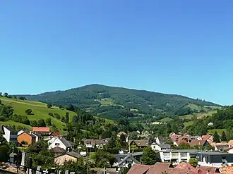 A general view of Lapoutroie | |
.svg.png) Coat of arms | |
Location of Lapoutroie | |
 Lapoutroie  Lapoutroie | |
| Coordinates: 48°09′12″N 7°10′13″E / 48.1533°N 7.1703°E | |
| Country | France |
| Region | Grand Est |
| Department | Haut-Rhin |
| Arrondissement | Colmar-Ribeauvillé |
| Canton | Sainte-Marie-aux-Mines |
| Intercommunality | Vallée de Kaysersberg |
| Government | |
| • Mayor (2020–2026) | Philippe Girardin[1] |
Area 1 | 21.12 km2 (8.15 sq mi) |
| Population (2022)[2] | 1,872 |
| • Density | 89/km2 (230/sq mi) |
| Time zone | UTC+01:00 (CET) |
| • Summer (DST) | UTC+02:00 (CEST) |
| INSEE/Postal code | 68175 /68650 |
| Elevation | 329–1,221 m (1,079–4,006 ft) (avg. 422 m or 1,385 ft) |
| 1 French Land Register data, which excludes lakes, ponds, glaciers > 1 km2 (0.386 sq mi or 247 acres) and river estuaries. | |
Lapoutroie (French pronunciation: [laputʁwa] ⓘ; German: Schnierlach; Welche: Lè Peutraille) is a commune in the Haut-Rhin department in Grand Est in north-eastern France.
See also
References
- ^ "Répertoire national des élus: les maires" (in French). data.gouv.fr, Plateforme ouverte des données publiques françaises. 13 September 2022.
- ^ "Populations de référence 2022" (in French). The National Institute of Statistics and Economic Studies. 19 December 2024.
Wikimedia Commons has media related to Lapoutroie.