Leimbach, Haut-Rhin
Leimbach | |
|---|---|
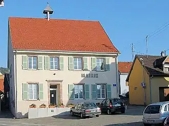 The town hall in Leimbach | |
.svg.png) Coat of arms | |
Location of Leimbach | |
 Leimbach  Leimbach | |
| Coordinates: 47°47′37″N 7°06′07″E / 47.7936°N 7.1019°E | |
| Country | France |
| Region | Grand Est |
| Department | Haut-Rhin |
| Arrondissement | Thann-Guebwiller |
| Canton | Cernay |
| Government | |
| • Mayor (2020–2026) | Philippe Ziegler[1] |
Area 1 | 3.57 km2 (1.38 sq mi) |
| Population (2022)[2] | 928 |
| • Density | 260/km2 (670/sq mi) |
| Time zone | UTC+01:00 (CET) |
| • Summer (DST) | UTC+02:00 (CEST) |
| INSEE/Postal code | 68180 /68800 |
| Elevation | 326–663 m (1,070–2,175 ft) (avg. 350 m or 1,150 ft) |
| 1 French Land Register data, which excludes lakes, ponds, glaciers > 1 km2 (0.386 sq mi or 247 acres) and river estuaries. | |
Leimbach (French pronunciation: [laimbak] ⓘ) is a commune in the Haut-Rhin department in Grand Est in north-eastern France.
Etymology
Leimbach was historically attested as Leymbach in 1223. The toponym Leimbach is of Germanic origin, cognate to modern German Lehm, denoting clay. The Germanic hydronym *-bak(i) entered the French language via High German, and took on two forms: the Germanic form -bach and Romantic -bais.[3]
See also
References
- ^ "Répertoire national des élus: les maires". data.gouv.fr, Plateforme ouverte des données publiques françaises (in French). 2 December 2020.
- ^ "Populations de référence 2022" (in French). The National Institute of Statistics and Economic Studies. 19 December 2024.
- ^ Caljouw, William Robert (1981). "Germanic elements in French Toponymy". University of British Columbia: 148, 150. doi:10.14288/1.0094985. Retrieved 2021-01-12.
{{cite journal}}: Cite journal requires|journal=(help)
Wikimedia Commons has media related to Leimbach (Haut-Rhin).