Wittelsheim
Wittelsheim
Wìttelsa | |
|---|---|
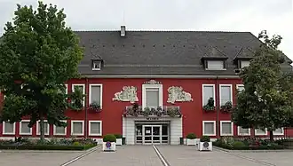 The town hall | |
.svg.png) Coat of arms | |
Location of Wittelsheim | |
 Wittelsheim  Wittelsheim | |
| Coordinates: 47°48′21″N 7°14′18″E / 47.8058°N 7.2383°E | |
| Country | France |
| Region | Grand Est |
| Department | Haut-Rhin |
| Arrondissement | Mulhouse |
| Canton | Wittenheim |
| Intercommunality | Mulhouse Alsace |
| Government | |
| • Mayor (2020–2026) | Yves Goepfert[1] |
Area 1 | 23.63 km2 (9.12 sq mi) |
| Population (2022)[2] | 10,364 |
| • Density | 440/km2 (1,100/sq mi) |
| Time zone | UTC+01:00 (CET) |
| • Summer (DST) | UTC+02:00 (CEST) |
| INSEE/Postal code | 68375 /68310 |
| Elevation | 239–285 m (784–935 ft) (avg. 265 m or 869 ft) |
| 1 French Land Register data, which excludes lakes, ponds, glaciers > 1 km2 (0.386 sq mi or 247 acres) and river estuaries. | |
Wittelsheim (French pronunciation: [vitəlsaim] ⓘ in Alsatian Wìttelsa, is a commune in the Haut-Rhin department in Grand Est in north-eastern France.
Population
| Year | Pop. | ±% p.a. |
|---|---|---|
| 1968 | 10,088 | — |
| 1975 | 10,032 | −0.08% |
| 1982 | 10,177 | +0.21% |
| 1990 | 10,452 | +0.33% |
| 1999 | 10,226 | −0.24% |
| 2007 | 10,606 | +0.46% |
| 2012 | 10,573 | −0.06% |
| 2017 | 10,355 | −0.42% |
| Source: INSEE[3] | ||
See also
References
- ^ "Répertoire national des élus: les maires". data.gouv.fr, Plateforme ouverte des données publiques françaises (in French). 2 December 2020.
- ^ "Populations de référence 2022" (in French). The National Institute of Statistics and Economic Studies. 19 December 2024.
- ^ Population en historique depuis 1968, INSEE
Wikimedia Commons has media related to Wittelsheim.