Raedersdorf
Raedersdorf | |
|---|---|
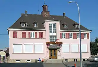 The town hall in Raedersdorf | |
.svg.png) Coat of arms | |
Location of Raedersdorf | |
 Raedersdorf  Raedersdorf | |
| Coordinates: 47°28′32″N 7°22′03″E / 47.4756°N 7.3675°E | |
| Country | France |
| Region | Grand Est |
| Department | Haut-Rhin |
| Arrondissement | Altkirch |
| Canton | Altkirch |
| Intercommunality | CC Sundgau |
| Government | |
| • Mayor (2020–2026) | Jean-Marc Metz[1] |
Area 1 | 7.39 km2 (2.85 sq mi) |
| Population (2022)[2] | 481 |
| • Density | 65/km2 (170/sq mi) |
| Time zone | UTC+01:00 (CET) |
| • Summer (DST) | UTC+02:00 (CEST) |
| INSEE/Postal code | 68259 /68480 |
| Elevation | 419–784 m (1,375–2,572 ft) (avg. 440 m or 1,440 ft) |
| 1 French Land Register data, which excludes lakes, ponds, glaciers > 1 km2 (0.386 sq mi or 247 acres) and river estuaries. | |
Raedersdorf (German: Rädersdorf) is a commune in the Haut-Rhin department in Alsace in north-eastern France.
Geography
Raedersdorf is located in the south of the so-called Alsatian jura, a community of communes. French-speaking Switzerland (Lucelle) and German-speaking Switzerland (Rodersdorf) are very close.
Population
| Year | Pop. | ±% p.a. |
|---|---|---|
| 1968 | 409 | — |
| 1975 | 420 | +0.38% |
| 1982 | 441 | +0.70% |
| 1990 | 491 | +1.35% |
| 1999 | 505 | +0.31% |
| 2009 | 505 | +0.00% |
| 2014 | 504 | −0.04% |
| 2020 | 504 | +0.00% |
| Source: INSEE[3] | ||
See also
References
- ^ "Répertoire national des élus: les maires" (in French). data.gouv.fr, Plateforme ouverte des données publiques françaises. 13 September 2022.
- ^ "Populations de référence 2022" (in French). The National Institute of Statistics and Economic Studies. 19 December 2024.
- ^ Population en historique depuis 1968, INSEE
Wikimedia Commons has media related to Raedersdorf.