Plagnole
Plagnole | |
|---|---|
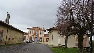 The town hall in Plagnole | |
.svg.png) Coat of arms | |
Location of Plagnole | |
 Plagnole  Plagnole | |
| Coordinates: 43°24′51″N 1°03′25″E / 43.4142°N 1.0569°E | |
| Country | France |
| Region | Occitania |
| Department | Haute-Garonne |
| Arrondissement | Muret |
| Canton | Cazères |
| Government | |
| • Mayor (2020–2026) | Georges Dupuy[1] |
Area 1 | 7.24 km2 (2.80 sq mi) |
| Population (2022)[2] | 333 |
| • Density | 46/km2 (120/sq mi) |
| Time zone | UTC+01:00 (CET) |
| • Summer (DST) | UTC+02:00 (CEST) |
| INSEE/Postal code | 31423 /31370 |
| Elevation | 228–347 m (748–1,138 ft) (avg. 350 m or 1,150 ft) |
| 1 French Land Register data, which excludes lakes, ponds, glaciers > 1 km2 (0.386 sq mi or 247 acres) and river estuaries. | |
Plagnole (French pronunciation: [plaɲɔl]; Occitan: Planhòla) is a commune in the Haute-Garonne department in southwestern France.
Population
| Year | Pop. | ±% |
|---|---|---|
| 1962 | 100 | — |
| 1968 | 128 | +28.0% |
| 1975 | 131 | +2.3% |
| 1982 | 147 | +12.2% |
| 1990 | 214 | +45.6% |
| 1999 | 271 | +26.6% |
| 2008 | 269 | −0.7% |
See also
References
- ^ "Répertoire national des élus: les maires". data.gouv.fr, Plateforme ouverte des données publiques françaises (in French). 2 December 2020.
- ^ "Populations de référence 2022" (in French). The National Institute of Statistics and Economic Studies. 19 December 2024.
Wikimedia Commons has media related to Plagnole.