Saint-Dionisy
Saint-Dionisy | |
|---|---|
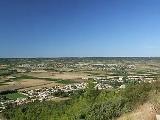 A general view of Saint-Dionisy | |
.svg.png) Coat of arms | |
Location of Saint-Dionisy | |
 Saint-Dionisy  Saint-Dionisy | |
| Coordinates: 43°48′20″N 4°13′46″E / 43.8056°N 4.2294°E | |
| Country | France |
| Region | Occitania |
| Department | Gard |
| Arrondissement | Nîmes |
| Canton | Saint-Gilles |
| Intercommunality | CA Nîmes Métropole |
| Government | |
| • Mayor (2020–2026) | Jean-Christophe Gregoire[1] |
Area 1 | 3.42 km2 (1.32 sq mi) |
| Population (2022)[2] | 1,071 |
| • Density | 310/km2 (810/sq mi) |
| Time zone | UTC+01:00 (CET) |
| • Summer (DST) | UTC+02:00 (CEST) |
| INSEE/Postal code | 30249 /30980 |
| Elevation | 36–181 m (118–594 ft) (avg. 70 m or 230 ft) |
| 1 French Land Register data, which excludes lakes, ponds, glaciers > 1 km2 (0.386 sq mi or 247 acres) and river estuaries. | |
Saint-Dionisy (French pronunciation: [sɛ̃ djɔnizi], formerly spelled Saint-Dionizy;[3] Occitan: Sent Dionisi) is a commune in the Gard department in southern France.
Population
| Year | Pop. | ±% |
|---|---|---|
| 1962 | 129 | — |
| 1968 | 160 | +24.0% |
| 1975 | 216 | +35.0% |
| 1982 | 370 | +71.3% |
| 1990 | 401 | +8.4% |
| 1999 | 633 | +57.9% |
| 2008 | 871 | +37.6% |
See also
References
- ^ "Répertoire national des élus: les maires". data.gouv.fr, Plateforme ouverte des données publiques françaises (in French). 9 August 2021.
- ^ "Populations de référence 2022" (in French). The National Institute of Statistics and Economic Studies. 19 December 2024.
- ^ Commune name change by decree no. 2011-311 dated 22 March 2011, accessed 15 May 2011.
External links
Wikimedia Commons has media related to Saint-Dionisy.