Saint-Groux
Saint-Groux | |
|---|---|
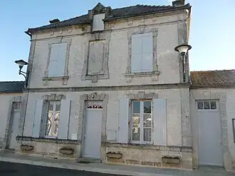 Town hall | |
Location of Saint-Groux | |
 Saint-Groux  Saint-Groux | |
| Coordinates: 45°53′52″N 0°10′07″E / 45.8978°N 0.1686°E | |
| Country | France |
| Region | Nouvelle-Aquitaine |
| Department | Charente |
| Arrondissement | Confolens |
| Canton | Boixe-et-Manslois |
| Government | |
| • Mayor (2020–2026) | Sigrid Faure[1] |
Area 1 | 4.50 km2 (1.74 sq mi) |
| Population (2022)[2] | 130 |
| • Density | 29/km2 (75/sq mi) |
| Time zone | UTC+01:00 (CET) |
| • Summer (DST) | UTC+02:00 (CEST) |
| INSEE/Postal code | 16326 /16230 |
| Elevation | 52–90 m (171–295 ft) (avg. 61 m or 200 ft) |
| 1 French Land Register data, which excludes lakes, ponds, glaciers > 1 km2 (0.386 sq mi or 247 acres) and river estuaries. | |
Saint-Groux (French pronunciation: [sɛ̃ ɡʁu]) is a commune in the Charente department in southwestern France.
Population
| Year | Pop. | ±% p.a. |
|---|---|---|
| 1968 | 84 | — |
| 1975 | 91 | +1.15% |
| 1982 | 94 | +0.46% |
| 1990 | 114 | +2.44% |
| 1999 | 122 | +0.76% |
| 2009 | 139 | +1.31% |
| 2014 | 132 | −1.03% |
| 2020 | 134 | +0.25% |
| Source: INSEE[3] | ||
See also
References
- ^ "Répertoire national des élus: les maires" (in French). data.gouv.fr, Plateforme ouverte des données publiques françaises. 13 September 2022.
- ^ "Populations de référence 2022" (in French). The National Institute of Statistics and Economic Studies. 19 December 2024.
- ^ Population en historique depuis 1968, INSEE
Wikimedia Commons has media related to Saint-Groux.