Střítež (Jihlava District)
Střítež | |
|---|---|
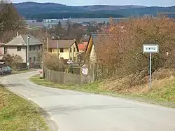 View from the east | |
_vlajka.jpg) Flag _znak.jpg) Coat of arms | |
 Střítež Location in the Czech Republic | |
| Coordinates: 49°27′23″N 15°37′41″E / 49.45639°N 15.62806°E | |
| Country | |
| Region | Vysočina |
| District | Jihlava |
| First mentioned | 1347 |
| Area | |
• Total | 7.46 km2 (2.88 sq mi) |
| Elevation | 483 m (1,585 ft) |
| Population (2025-01-01)[1] | |
• Total | 481 |
| • Density | 64/km2 (170/sq mi) |
| Time zone | UTC+1 (CET) |
| • Summer (DST) | UTC+2 (CEST) |
| Postal code | 588 11 |
| Website | www |
Střítež (Czech pronunciation: [ˈstr̝̊iːtɛʃ]) is a municipality and village in Jihlava District in the Vysočina Region of the Czech Republic. It has about 500 inhabitants.
Střítež lies approximately 8 kilometres (5 mi) north of Jihlava and 112 km (70 mi) south-east of Prague.
Demographics
| Year | Pop. | ±% |
|---|---|---|
| 1869 | 742 | — |
| 1880 | 610 | −17.8% |
| 1890 | 861 | +41.1% |
| 1900 | 562 | −34.7% |
| 1910 | 526 | −6.4% |
| 1921 | 1,010 | +92.0% |
| 1930 | 653 | −35.3% |
| 1950 | 844 | +29.2% |
| 1961 | 841 | −0.4% |
| 1970 | 489 | −41.9% |
| 1980 | 338 | −30.9% |
| 1991 | 319 | −5.6% |
| 2001 | 332 | +4.1% |
| 2011 | 390 | +17.5% |
| 2021 | 457 | +17.2% |
| Source: Censuses[2][3] | ||
References
- ^ "Population of Municipalities – 1 January 2025". Czech Statistical Office. 2025-05-16.
- ^ "Historický lexikon obcí České republiky 1869–2011" (in Czech). Czech Statistical Office. 2015-12-21.
- ^ "Population Census 2021: Population by sex". Public Database. Czech Statistical Office. 2021-03-27.
External links
Wikimedia Commons has media related to Střítež (Jihlava District).