Trotina
Trotina | |
|---|---|
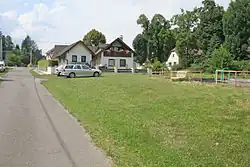 Side street | |
 Flag  Coat of arms | |
 Trotina Location in the Czech Republic | |
| Coordinates: 50°24′35″N 15°42′59″E / 50.40972°N 15.71639°E | |
| Country | |
| Region | Hradec Králové |
| District | Trutnov |
| First mentioned | 1238 |
| Area | |
• Total | 1.58 km2 (0.61 sq mi) |
| Elevation | 386 m (1,266 ft) |
| Population (2025-01-01)[1] | |
• Total | 95 |
| • Density | 60/km2 (160/sq mi) |
| Time zone | UTC+1 (CET) |
| • Summer (DST) | UTC+2 (CEST) |
| Postal code | 544 01 |
| Website | www |
Trotina is a municipality and village in Trutnov District in the Hradec Králové Region of the Czech Republic. It has about 100 inhabitants.
Demographics
| Year | Pop. | ±% |
|---|---|---|
| 1869 | 305 | — |
| 1880 | 276 | −9.5% |
| 1890 | 296 | +7.2% |
| 1900 | 278 | −6.1% |
| 1910 | 273 | −1.8% |
| 1921 | 238 | −12.8% |
| 1930 | 202 | −15.1% |
| 1950 | 138 | −31.7% |
| 1961 | 139 | +0.7% |
| 1970 | 95 | −31.7% |
| 1980 | 90 | −5.3% |
| 1991 | 85 | −5.6% |
| 2001 | 61 | −28.2% |
| 2011 | 78 | +27.9% |
| 2021 | 91 | +16.7% |
| Source: Censuses[2][3] | ||
References
- ^ "Population of Municipalities – 1 January 2025". Czech Statistical Office. 2025-05-16.
- ^ "Historický lexikon obcí České republiky 1869–2011" (in Czech). Czech Statistical Office. 2015-12-21.
- ^ "Population Census 2021: Population by sex". Public Database. Czech Statistical Office. 2021-03-27.
External links
Wikimedia Commons has media related to Trotina.