Úherce (Louny District)
Úherce | |
|---|---|
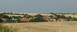 View from the south | |
_Flag.jpg) Flag _CoA.png) Coat of arms | |
 Úherce Location in the Czech Republic | |
| Coordinates: 50°17′53″N 13°56′57″E / 50.29806°N 13.94917°E | |
| Country | |
| Region | Ústí nad Labem |
| District | Louny |
| First mentioned | 1088 |
| Area | |
• Total | 3.47 km2 (1.34 sq mi) |
| Elevation | 305 m (1,001 ft) |
| Population (2025-01-01)[1] | |
• Total | 101 |
| • Density | 29/km2 (75/sq mi) |
| Time zone | UTC+1 (CET) |
| • Summer (DST) | UTC+2 (CEST) |
| Postal code | 440 01 |
| Website | www |
Úherce is a municipality and village in Louny District in the Ústí nad Labem Region of the Czech Republic. It has about 100 inhabitants.
Úherce lies approximately 13 kilometres (8 mi) south-east of Louny, 41 km (25 mi) south of Ústí nad Labem, and 42 km (26 mi) north-west of Prague.
Demographics
| Year | Pop. | ±% |
|---|---|---|
| 1869 | 291 | — |
| 1880 | 311 | +6.9% |
| 1890 | 291 | −6.4% |
| 1900 | 289 | −0.7% |
| 1910 | 295 | +2.1% |
| 1921 | 265 | −10.2% |
| 1930 | 236 | −10.9% |
| 1950 | 165 | −30.1% |
| 1961 | 156 | −5.5% |
| 1970 | 123 | −21.2% |
| 1980 | 101 | −17.9% |
| 1991 | 72 | −28.7% |
| 2001 | 58 | −19.4% |
| 2011 | 75 | +29.3% |
| 2021 | 84 | +12.0% |
| Source: Censuses[2][3] | ||
References
- ^ "Population of Municipalities – 1 January 2025". Czech Statistical Office. 2025-05-16.
- ^ "Historický lexikon obcí České republiky 1869–2011" (in Czech). Czech Statistical Office. 2015-12-21.
- ^ "Population Census 2021: Population by sex". Public Database. Czech Statistical Office. 2021-03-27.
External links
Wikimedia Commons has media related to Úherce (Louny District).