Hříškov
Hříškov | |
|---|---|
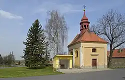 Chapel of the Holy Trinity | |
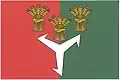 Flag 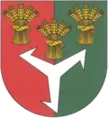 Coat of arms | |
 Hříškov Location in the Czech Republic | |
| Coordinates: 50°17′29″N 13°51′52″E / 50.29139°N 13.86444°E | |
| Country | |
| Region | Ústí nad Labem |
| District | Louny |
| First mentioned | 1318 |
| Area | |
• Total | 10.26 km2 (3.96 sq mi) |
| Elevation | 390 m (1,280 ft) |
| Population (2025-01-01)[1] | |
• Total | 391 |
| • Density | 38/km2 (99/sq mi) |
| Time zone | UTC+1 (CET) |
| • Summer (DST) | UTC+2 (CEST) |
| Postal codes | 439 04, 440 01 |
| Website | www |
Hříškov (German: Rischkau) is a municipality and village in Louny District in the Ústí nad Labem Region of the Czech Republic. It has about 400 inhabitants.
Hříškov lies approximately 10 kilometres (6 mi) south-east of Louny, 44 km (27 mi) south of Ústí nad Labem, and 46 km (29 mi) north-west of Prague.
Administrative division
Hříškov consists of three municipal parts (in brackets population according to the 2021 census):[2]
- Hříškov (330)
- Bedřichovice (69)
- Hvížďalka (13)
Demographics
| Year | Pop. | ±% |
|---|---|---|
| 1869 | 993 | — |
| 1880 | 973 | −2.0% |
| 1890 | 956 | −1.7% |
| 1900 | 978 | +2.3% |
| 1910 | 1,022 | +4.5% |
| 1921 | 935 | −8.5% |
| 1930 | 914 | −2.2% |
| 1950 | 637 | −30.3% |
| 1961 | 608 | −4.6% |
| 1970 | 539 | −11.3% |
| 1980 | 458 | −15.0% |
| 1991 | 346 | −24.5% |
| 2001 | 347 | +0.3% |
| 2011 | 395 | +13.8% |
| 2021 | 412 | +4.3% |
| Source: Censuses[3][4] | ||
References
- ^ "Population of Municipalities – 1 January 2025". Czech Statistical Office. 2025-05-16.
- ^ "Public Census 2021 – basic data". Public Database (in Czech). Czech Statistical Office. 2022.
- ^ "Historický lexikon obcí České republiky 1869–2011" (in Czech). Czech Statistical Office. 2015-12-21.
- ^ "Population Census 2021: Population by sex". Public Database. Czech Statistical Office. 2021-03-27.
External links
Wikimedia Commons has media related to Hříškov.