Dobroměřice
Dobroměřice | |
|---|---|
_-_are%C3%A1l_kostela_sv._Matou%C5%A1e_(srpen_2022)_(7).jpg) Church of Saint Matthew | |
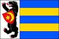 Flag 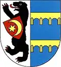 Coat of arms | |
 Dobroměřice Location in the Czech Republic | |
| Coordinates: 50°22′13″N 13°47′41″E / 50.37028°N 13.79472°E | |
| Country | |
| Region | Ústí nad Labem |
| District | Louny |
| First mentioned | 1219 |
| Area | |
• Total | 4.85 km2 (1.87 sq mi) |
| Elevation | 185 m (607 ft) |
| Population (2025-01-01)[1] | |
• Total | 1,407 |
| • Density | 290/km2 (750/sq mi) |
| Time zone | UTC+1 (CET) |
| • Summer (DST) | UTC+2 (CEST) |
| Postal code | 440 01 |
| Website | www |
Dobroměřice is a municipality and village in Louny District in the Ústí nad Labem Region of the Czech Republic. It has about 1,400 inhabitants.
Dobroměřice lies approximately 3 kilometres (2 mi) north of Louny, 37 km (23 mi) southwest of Ústí nad Labem, and 56 km (35 mi) northwest of Prague.
Demographics
| Year | Pop. | ±% |
|---|---|---|
| 1869 | 305 | — |
| 1880 | 497 | +63.0% |
| 1890 | 579 | +16.5% |
| 1900 | 814 | +40.6% |
| 1910 | 812 | −0.2% |
| 1921 | 841 | +3.6% |
| 1930 | 1,230 | +46.3% |
| 1950 | 1,020 | −17.1% |
| 1961 | 1,003 | −1.7% |
| 1970 | 957 | −4.6% |
| 1980 | 1,133 | +18.4% |
| 1991 | 1,269 | +12.0% |
| 2001 | 1,292 | +1.8% |
| 2011 | 1,377 | +6.6% |
| 2021 | 1,388 | +0.8% |
| Source: Censuses[2][3] | ||
References
- ^ "Population of Municipalities – 1 January 2025". Czech Statistical Office. 2025-05-16.
- ^ "Historický lexikon obcí České republiky 1869–2011" (in Czech). Czech Statistical Office. 2015-12-21.
- ^ "Population Census 2021: Population by sex". Public Database. Czech Statistical Office. 2021-03-27.
External links
Wikimedia Commons has media related to Dobroměřice.