Hřivice
Hřivice | |
|---|---|
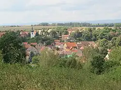 General view | |
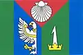 Flag 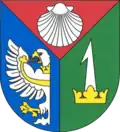 Coat of arms | |
 Hřivice Location in the Czech Republic | |
| Coordinates: 50°17′18″N 13°43′49″E / 50.28833°N 13.73028°E | |
| Country | |
| Region | Ústí nad Labem |
| District | Louny |
| First mentioned | 1316 |
| Area | |
• Total | 13.42 km2 (5.18 sq mi) |
| Elevation | 270 m (890 ft) |
| Population (2025-01-01)[1] | |
• Total | 631 |
| • Density | 47/km2 (120/sq mi) |
| Time zone | UTC+1 (CET) |
| • Summer (DST) | UTC+2 (CEST) |
| Postal codes | 439 65, 440 01 |
| Website | www |
Hřivice is a municipality and village in Louny District in the Ústí nad Labem Region of the Czech Republic. It has about 600 inhabitants.
Hřivice lies approximately 10 kilometres (6 mi) south-west of Louny, 48 km (30 mi) south-west of Ústí nad Labem, and 54 km (34 mi) north-west of Prague.
Administrative division
Hřivice consists of three municipal parts (in brackets population according to the 2021 census):[2]
- Hřivice (352)
- Markvarec (63)
- Touchovice (206)
Demographics
| Year | Pop. | ±% |
|---|---|---|
| 1869 | 1,076 | — |
| 1880 | 1,181 | +9.8% |
| 1890 | 1,286 | +8.9% |
| 1900 | 1,370 | +6.5% |
| 1910 | 1,351 | −1.4% |
| 1921 | 1,414 | +4.7% |
| 1930 | 1,446 | +2.3% |
| 1950 | 1,074 | −25.7% |
| 1961 | 986 | −8.2% |
| 1970 | 897 | −9.0% |
| 1980 | 740 | −17.5% |
| 1991 | 594 | −19.7% |
| 2001 | 582 | −2.0% |
| 2011 | 623 | +7.0% |
| 2021 | 621 | −0.3% |
| Source: Censuses[3][4] | ||
References
- ^ "Population of Municipalities – 1 January 2025". Czech Statistical Office. 2025-05-16.
- ^ "Public Census 2021 – basic data". Public Database (in Czech). Czech Statistical Office. 2022.
- ^ "Historický lexikon obcí České republiky 1869–2011" (in Czech). Czech Statistical Office. 2015-12-21.
- ^ "Population Census 2021: Population by sex". Public Database. Czech Statistical Office. 2021-03-27.
External links
Wikimedia Commons has media related to Hřivice.