Běleč (Brno-Country District)
Běleč | |
|---|---|
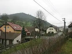 Centre of Běleč | |
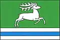 Flag 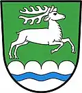 Coat of arms | |
 Běleč Location in the Czech Republic | |
| Coordinates: 49°26′2″N 16°22′59″E / 49.43389°N 16.38306°E | |
| Country | |
| Region | South Moravian |
| District | Brno-Country |
| First mentioned | 1447 |
| Area | |
• Total | 4.03 km2 (1.56 sq mi) |
| Elevation | 406 m (1,332 ft) |
| Population (2025-01-01)[1] | |
• Total | 205 |
| • Density | 51/km2 (130/sq mi) |
| Time zone | UTC+1 (CET) |
| • Summer (DST) | UTC+2 (CEST) |
| Postal code | 679 23 |
| Website | www |
Běleč is a municipality and village in Brno-Country District in the South Moravian Region of the Czech Republic. It has about 200 inhabitants.
Běleč lies approximately 31 kilometres (19 mi) north-west of Brno and 159 km (99 mi) south-east of Prague.
Administrative division
Běleč consists of two municipal parts (in brackets population according to the 2021 census):[2]
- Běleč (137)
- Křeptov (54)
Demographics
| Year | Pop. | ±% |
|---|---|---|
| 1869 | 190 | — |
| 1880 | 247 | +30.0% |
| 1890 | 232 | −6.1% |
| 1900 | 237 | +2.2% |
| 1910 | 264 | +11.4% |
| 1921 | 286 | +8.3% |
| 1930 | 276 | −3.5% |
| 1950 | 309 | +12.0% |
| 1961 | 323 | +4.5% |
| 1970 | 277 | −14.2% |
| 1980 | 249 | −10.1% |
| 1991 | 218 | −12.4% |
| 2001 | 194 | −11.0% |
| 2011 | 186 | −4.1% |
| 2021 | 191 | +2.7% |
| Source: Censuses[3][4] | ||
References
- ^ "Population of Municipalities – 1 January 2025". Czech Statistical Office. 2025-05-16.
- ^ "Public Census 2021 – basic data". Public Database (in Czech). Czech Statistical Office. 2022.
- ^ "Historický lexikon obcí České republiky 1869–2011" (in Czech). Czech Statistical Office. 2015-12-21.
- ^ "Population Census 2021: Population by sex". Public Database. Czech Statistical Office. 2021-03-27.
External links
Wikimedia Commons has media related to Běleč (Brno-Country District).