Ponětovice
Ponětovice | |
|---|---|
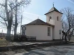 Chapel of Saint John of Nepomuk | |
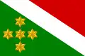 Flag 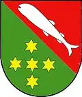 Coat of arms | |
 Ponětovice Location in the Czech Republic | |
| Coordinates: 49°9′8″N 16°44′32″E / 49.15222°N 16.74222°E | |
| Country | |
| Region | South Moravian |
| District | Brno-Country |
| First mentioned | 1306 |
| Area | |
• Total | 2.41 km2 (0.93 sq mi) |
| Elevation | 220 m (720 ft) |
| Population (2025-01-01)[1] | |
• Total | 445 |
| • Density | 180/km2 (480/sq mi) |
| Time zone | UTC+1 (CET) |
| • Summer (DST) | UTC+2 (CEST) |
| Postal code | 664 51 |
| Website | www |
Ponětovice is a municipality and village in Brno-Country District in the South Moravian Region of the Czech Republic. It has about 400 inhabitants.
Ponětovice lies approximately 12 kilometres (7 mi) south-east of Brno and 198 km (123 mi) south-east of Prague.
Demographics
| Year | Pop. | ±% |
|---|---|---|
| 1869 | 230 | — |
| 1880 | 265 | +15.2% |
| 1890 | 272 | +2.6% |
| 1900 | 303 | +11.4% |
| 1910 | 300 | −1.0% |
| 1921 | 343 | +14.3% |
| 1930 | 379 | +10.5% |
| 1950 | 351 | −7.4% |
| 1961 | 372 | +6.0% |
| 1970 | 363 | −2.4% |
| 1980 | 343 | −5.5% |
| 1991 | 313 | −8.7% |
| 2001 | 298 | −4.8% |
| 2011 | 377 | +26.5% |
| 2021 | 419 | +11.1% |
| Source: Censuses[2][3] | ||
References
- ^ "Population of Municipalities – 1 January 2025". Czech Statistical Office. 2025-05-16.
- ^ "Historický lexikon obcí České republiky 1869–2011" (in Czech). Czech Statistical Office. 2015-12-21.
- ^ "Population Census 2021: Population by sex". Public Database. Czech Statistical Office. 2021-03-27.
External links
Wikimedia Commons has media related to Ponětovice.