Unín (Brno-Country District)
Unín | |
|---|---|
.jpg) Church of Saints Peter and Paul | |
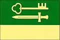 Flag 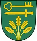 Coat of arms | |
 Unín Location in the Czech Republic | |
| Coordinates: 49°22′56″N 16°29′29″E / 49.38222°N 16.49139°E | |
| Country | |
| Region | South Moravian |
| District | Brno-Country |
| First mentioned | 1349 |
| Area | |
• Total | 3.35 km2 (1.29 sq mi) |
| Elevation | 461 m (1,512 ft) |
| Population (2025-01-01)[1] | |
• Total | 242 |
| • Density | 72/km2 (190/sq mi) |
| Time zone | UTC+1 (CET) |
| • Summer (DST) | UTC+2 (CEST) |
| Postal code | 679 24 |
| Website | www |
Unín is a municipality and village in Brno-Country District in the South Moravian Region of the Czech Republic. It has about 200 inhabitants.
Unín lies approximately 23 kilometres (14 mi) north-west of Brno and 169 km (105 mi) south-east of Prague.
Demographics
| Year | Pop. | ±% |
|---|---|---|
| 1869 | 172 | — |
| 1880 | 199 | +15.7% |
| 1890 | 211 | +6.0% |
| 1900 | 203 | −3.8% |
| 1910 | 216 | +6.4% |
| 1921 | 248 | +14.8% |
| 1930 | 222 | −10.5% |
| 1950 | 207 | −6.8% |
| 1961 | 197 | −4.8% |
| 1970 | 289 | +46.7% |
| 1980 | 213 | −26.3% |
| 1991 | 174 | −18.3% |
| 2001 | 196 | +12.6% |
| 2011 | 203 | +3.6% |
| 2021 | 221 | +8.9% |
| Source: Censuses[2][3] | ||
References
- ^ "Population of Municipalities – 1 January 2025". Czech Statistical Office. 2025-05-16.
- ^ "Historický lexikon obcí České republiky 1869–2011" (in Czech). Czech Statistical Office. 2015-12-21.
- ^ "Population Census 2021: Population by sex". Public Database. Czech Statistical Office. 2021-03-27.
External links
Wikimedia Commons has media related to Unín.